(Much of) the West Coast in Three Weeks
(a suggested itinerary for K. and N.)
Well hello, you two,
N. asked me for my advice on a west coast trip a few weeks ago, since neither of you is from here and neither of you have traveled extensively on this side of the continent, and I've been pondering it since then. I started throwing together some suggestions in a spreadsheet, and then it became a shortish narrative, and now it's become a much longer quasi-essay than I ever would have expected. It's based on my own travels up and down the west coast over the last few decades, and it's of course limited in the standard ways: by my own interests, and what I've enjoyed and been fond of, and the people I've known, and what I think I know about what the two of you might want to do, and the places that I've wanted to come back to. Doubtless there's much I've missed, and doubtless there's much that's worth doing from California to Washington State that I've never done.
I've tried to balance many things here: this itinerary plans for you to spend some time driving and some time out of the car (I try to break driving up into manageable chunks while still making sure there's something worth doing on every day of the trip); you hit five of the big six cities on the west coast (excluding Los Angeles, which you've both explored on your own during your time living at the north end of its outer orbit). I've split the long and beautiful drive on Highway 101 into several chunks to keep it from being one long excruciatingly slow trip all the way down the Pacific coast, and I try to point out particularly good places to detour briefly onto the even-more-beautiful Highway 1. You see the nicer parts of I-5 but skip most of the dusty and hot and dull parts in southern California; you see the biggest and most iconic national parks in the area; and I try to point out good places to camp, and to recommend good food and hotels when I know about them. I'll gesture towards opportunities for culture, and to (what I take to be) the very best beaches, and to those places that I most hope to see on your Instagram feeds. At the same time, I've tried to think out scheduling, to put you in places worth going while they're open, or during peak ideal times, as often as possible, because this of course maximizes the amount of fun you can have.
But of course the standard caveat applies: if you were to take such a vacation, why, it would be your vacation, and you should do what you want with it, and use it to chase your own interests. You won't hurt my feelings by making alterations; in fact, you should do your own research and find things that aren't on this list that appeal to you, and then tell me about them. I've made some suggestions for alterations along the way (there are more suggested side-trips then there are days in the trip), and if you want advice, you have my number; you can certainly text or call me with questions. And if you get stuck, I know people in many places along the way that I may be able to put you in touch with.)
So this is for you two. Let me know what you think. Let me know what you do.
Basic suggestions
Some amount of advance planning will pay off: I've tried to indicate below when worthwhile things require substantial advance reservations. (I also try not to say this frivolously.) I'm assuming that you'll want to spend some time camping, but will not want to camp every night. All in all, I'd advise a somewhat-better-than-minimal set of camping equipment: warmish sleeping bags (polar-level not required), a tent that's not a pain in the ass to set up, plus a few extra blankets (some of the ideal places to camp on this trip are rather cold; at least one is more than mile above sea level) and, ideally, an air mattress; plus basic firemaking equipment. It's not a bad idea to keep a bundle or two of firewood in your trunk, because it's not always easy to buy in areas where you're camping—at many places, it's only possible to legally obtain firewood from a camp host
, and s/he may sell it at exorbitant prices or stop being available to the people they're hosting
after, say, 6 p.m., whereas you may want to check in later than that. Keeping a bundle in your trunk may mean you don't get stuck without fire for an evening. Yes, there are those who will tell you that it's an ecological crime to carry wood with you because you may also be transporting invasive small insects into an ecosystem, but (a) wood you buy at a reputable grocery store is already pretty low on insects, so this is a low-likelihood problem, and (b) people who really believe this need to start pitching their complaints toward people who can increase the availability of firewood in actual camping areas rather than campers they're asking to go without fire for a night. No, it's not reasonable to ask campers to do research about wood availability ahead of time and then schedule their driving so that they can get in early enough to buy firewood from remote convenience stores and live-in camp hospitality.
At the same time, it's not a bad idea to keep some backup food and water in the car. I'm not sending you anywhere genuinely desolate, but there are parts of the west coast that are surprisingly sparsely populated if you grew up in, say, Virginia; and you will in fact be driving through places where the only town in a forty-mile drive has only two grocery stores, both of which roll up their sidewalks around ten p.m. No, you won't starve; but if you take a detour and roll up to your intended destination late at night, you may decide you're glad to have the fruit/cookies/crackers/sandwich materials in your car as an alternative to what the gas station twenty miles away can get you. (In all fairness, the west coast is better populated than some of the places where I've regretted not taking this advice myself, and you'll rarely see the extreme version of this problem, and I try to be explicit at those points in the route when you should plan ahead. But it's not a bad idea to keep some snacks in the car.)
There are enough trips through National Park Service lands that it may be worth your while to buy an annual pass (currently $80 and covers everyone in your car), especially if you're going to be taking some of the side trips; you can do so online or by phone. You can also buy them at most national parks, though doing so is betting that the ranger station is going to be staffed when you get there; it's often the case that they're on the honor system for camping registration/park entrance fees, but that there's no way to buy an annual pass when the entry booth is unstaffed. Your first opportunities to purchase at a park would be at Lava Beds (if you take that side trip) or Crater Lake.
On the whole, the route plan as written has you making forward progress
on 16 of the 24 days; since the route without side-trips totals almost exactly 3200 miles in a long, tilted figure-eight lying over the three westernmost states, the average driving distance for a day in the car is about 200 miles; only three days have scheduled drives of more than 250 miles. All in all, it's not a bad route; but, again, it's your vacation and you should alter it as you see fit. Alternately, the total driving for making forward progress, assuming good luck with traffic and rednecks and construction and accidents, is about 60 hours; that's a little under four hours per day for days when you're in the car, with only one day of more than five and a half hours. (But, to be perfectly honest, you're going to hit traffic snags of some kind along the way.)
I've made a number of suggestions about how to take side trips, but there are a few suggestions for major alterations in the route that are worth mentioning:
- Forget San Diego. I mention below that San Diego is my least favorite part of the trip. I also try to be fair below by saying that this is of course a matter of personal opinion and that your mileage may vary, etc. Nevertheless, in my own opinion, the best part of San Diego is the beer, and everything else is not enough to draw you down that far; and you'll have plenty of opportunities for good beer without driving that far; and not driving to San Diego would cut 250 miles of driving for you, and give you an extra two days or so to expand other visits or go on side trips. As I say, it's your trip, and you should do what you feel is best. But, in truth, I added San Diego primarily because it's a large west-coast city that has a large presence in cultural productions from (and about) California.
- Run through the trip backwards. This changes the character of the trip subtly, but in some ways substantially: it gets you out of the cities on weekends a little bit more, which may save you some money on hotels; but it puts you in campgrounds on weekends a bit more, too, which makes reservations even more necessary than they would be otherwise. It also means that you'll be taking the slow-drive segment early in the trip, and will be coming back down Interstate 5 at the end, which may appeal to you if you'd rather just plow through at the end and get home. Your call.
- Skip some intermediate stops and just plow through. There are a few places where my claim above to have tried to find something for you to do every day is tenuous, or where you really don't have much driving to do; this is perhaps most notable on days 2 (unless you're taking at least one of the side trips), 3 (if you don't want to see anything that's available on stage in Ashland), and 14 or 15 (if you don't want two nights in a row of redwoods camping). You might find that these days as written give you a welcome chance to get out of the car after comparatively heavy driving days; but you might just want to move on and buy some time. As always, it's your vacation, and you should do what feels best to you.
Day 1 (Fri): Goleta to San Jose

So you're off! The drive is quite pretty (you've taken some of it before; it gets even nicer as you get further north). Truthfully, if I were in your place, I wouldn't bother stopping much during this drive; you're not passing anything that you can't get back to on a day trip. Get up early and go see those friends of yours. If I were you, and assuming they're not opposed to booze, I'd try to get them to meet you at Hermitage Brew Co.: they have really really good beer.
Breakfast: Alfie's (Goleta) or any other nearby stop, or eat at home.
Lunch: See the San Luis Obispo side trip; you'll be passing through SLO anyway.
Dinner: Ask your SJ friends. They'll have good advice.
Notable Booze: Hermitage (San Jose) does both VERY nice IPAs and VERY nice Belgian-style beers. Rabbit's Foot Meadery is supposed to be good, but I've not had their mead.
Where to Stay: Your friends in SJ, no?
Optional stops: If you've got a hard-on for garlic, stop at a farm stand in Gilroy (Garlic capital of the world!
); there are also non-garlic fruits and veggies all around there if that's about where you need a snack.
Total driving today: 283 miles (a little over four hours). (Route.)
Detour: stop in San Luis Obispo
If you want to see some of San Luis Obispo without sacrificing time in San Jose, you can leave Goleta earlier in the morning. There are a lot of potential stops in SLO County, and some of them are worthwhile, but overall, I myself find SLO to be the most boring 45,000 smug upper-middle-class white people you'll ever see crammed into a central coast town. A lot of what's there is unfortunately both overhyped and overpriced, and filled with aging soccer moms fiercely insisting that some local/artisinal/organic thing or experience that's under discussion was totally amazing, shut up at every table around you as part of their pretense that they're not made of leather. But there are things worth seeing here, and it's one of the better stops in the middle of the Goleta-to-San Jose run, which is pretty but short on stopping places that would really draw you in.
If you're looking for particularly pretty nature-y things, see the Morro Bay and Hwy 1 detours.
Lunch/Dinner: Good lunch and dinner options include Sidecar (also notable for its excellent cocktails) and Petra (almost right next door: pretty good Mediterranean food, and have the donkey balls for dessert). There are plenty of organic farm stands around that are worth stopping at if you want to grab snacky things; two worth mentioning are Avila Valley Barn (not far out of your way to/from Morro Bay or Pirates' Cove, if you take those side trips, and right near Sycamore Mineral Springs) and Jack Creek Farms, (Templeton, a little north of SLO). You can see this for more information if you've got a hard-to-scratch itch for organic produce.
Notable Booze: Bang the Drum Brewery, Central Coast Brewing, and/or Libertine Brewing Company are all more or less downtown; any is worth a stop. Libertine has a nicer location in Morro Bay if you're taking that side-trip, but the location in downtown SLO is good too. There is, however, no need to feel disappointed if you're too rushed to stop for a beer.
Where to Stay: I wouldn't; I'd advise driving more than two hours before you stop on your first day.
Extra driving for this stop: just what it takes to get around town; you're passing through SLO anyway.
Detour: Morro Bay


Lunch: Libertine Brewing or some seaside restaurant, or anything listed in the SLO side-trip.
Dinner: Ask your SJ friends, who certainly know the city better than I do.
Booze: Libertine Brewing is here. They also have a tasting room in downtown SLO, but the one in Morro Bay is prettier, serves totally decent food, and is right on the water; plus, there's a very charming little waterfront area if it's nice and you feel like an arm-in-arm stroll with your beau where you can pay to press a souvenir penny out of a regular penny, should you have any pennies on you in the 21st century.
Where to Stay: If you really want to stop driving this early, camping in or near Morro Bay is plausible. I will vouch for Morro Bay State Park, which is quite beautiful and comfortable, though there are also any number of small hotels in the area. Really, though, move on to SJ before night falls. Morro Bay isn't worth ditching your friends for.
Outdoors/nature stuff: Well, there's the whole drive up Hwy 1, which I've written up as a side-trip on its own (though it's not, as of the time of this writing, possible to drive straight through due to a bridge problem; see that write-up for more information). If that's too much of a commitment but you want to get outside, you're near the beach, and there's a clothing-optional beach at Pirate's Cove. It's slightly south of town. Make sure to check a tide chart to avoid the disappointment of getting there and discovering it's not accessible, and bring a couple of beers and plan for a worthwhile-and-not-terrible hike down, then back up, and on the way out (or back), you can (should you have more money than you know what to do with on this trip) think about booking time in a private hot-spring tub at Sycamore Mineral Springs, which is supposed to be quite an excellent and relaxing hour, from what I've heard; the basic idea is that you can soak in private and enjoy your privacy without being hassled. Whatever that may mean to you.
Extra driving for this stop: Pirate's Cove is only 7 miles out of your way (one way); it's slightly south of SLO, so you'll want to get off the 101 early. Morro Bay adds 13 miles (17 minutes) each way from downtown SLO. (Route.)
Detour: Hwy 1 from SLO to Monterey
I recommend driving part of Hwy 1 at some point, and normally this is one of the easier ways to see part of it, and it is very very pretty. However, as of the time of this writing, it's impossible to take this as an alternate route because a bridge on this part of the highway is damaged and impassible; though it's always possible that that work could be done faster than expected, it's not particularly likely that it will be done this summer. As of right now, anyway, the only way to take this detour would be to take the southern part (getting on via SLO) and northern part (approaching via Monterey) separately (or pick one or the other) instead of driving straight through. That makes this detour a lot more time-consuming than it would be if it were just an alternate route.
Anyway, this segment is normally one of the best ways to see part of Hwy 1, and I do in fact recommend it if the construction work has proceeded far enough to let you through by the time you take your road trip. It's a slowish drive, though, even under ideal conditions, and if you wind up behind some asshole in an RV rubbernecking at the scenery while doing 22 miles per hour, you're going to be waiting a loooooong time to pass. As with any time you're driving along a smaller highway, fill your gas tank before you get off a larger road if you don't want to be paying several dollars per gallon extra at the edge of some godforsaken rock because you're out of gas and have no other options, and make sure to plan ahead and know where you're going to be buying gas and food next. There is a lot of ocean to see here and it really is gorgeous, though, and Pfeiffer Big Sur state park is a nice picnic stop if you manage to hit it around lunch time.
The whole highway is jaw-droppingly gorgeous and perhaps (again, assuming you can take it as a detour) the best part of Hwy 1 to see (though this is a highly contentious claim); it may be the way to see part of Hwy 1 that adds the least driving time, too. (Or, again, it would be normally.) There are very nice beaches, cliffs, and forests to look at in this area. You're passing through Big Sur on this route, which is a draw on its own. You can stop to watch cavorting seals pretending that they don't look like idiots if you want (and provided you have some luck): the area around San Simeon is a good bet (watch for signs).
Speaking of San Simeon, that's where Hearst Castle is, and you can stop and see it if you'd like. (Look at what media funds could buy the already-wealthy in the early twentieth century! Make yourself sick over the excesses of the disgustingly rich!) The bare minimum for the stop is probably at least 2½ hours, in part because you can't just park and wander in to the grounds; access to the castle involves parking and taking a trolley up a steep hillside between the parking lot (about sea level) and the castle itself (atop a hill). (Announcements on the trolley are narrated, weirdly, by Alex Trebek. At least, they were when I went up.) Moreover, I think you have to buy a ticket to take a tour in order to get up to the castle in the first place. But the building and the grounds really are beautiful, and the tour itself is kind of fun.
Lunch: Options are pretty limited. Scrounge what you can or bring a snack, or grab something in SLO or Morro Bay before heading up Hwy 1. One option is to stop at the entrance to Hearst Castle in San Simeon, at the bottom of the hill, where you can buy various foods made from the very same cattle that you'll see grazing on the hillsides if you take the trolley up the hill atop which the castle sits.
Booze: The only place I know of worth stopping is Libertine, mentioned above in the Morro Bay detour.
Where to Stay: You can camp around here if you really want to (the best options are probably around Big Sur if you want to do so—I'd make reservations if you're counting on doing this in the summer on a weekend), but I recommend driving further than this on your first day.
Extra driving: Assuming you can drive all the way up this section of Hwy 1: 20 miles (60 minutes).Just heading to Hearst Castle, then heading back south far enough to cut back to Hwy 101: 51 miles (65 minutes). (Route.) Detouring to Pfeiffer Big Sur on your way to San Jose: 90 miles (2 hours). (Route.)
Detour: Monterey
If you want to stop here, try to do so on the way in to SJ; otherwise, you're volunteering to do a good chunk of backtracking on your way out. The Monterey Bay Aquarium is excellent if you want to see an aquarium; it's probably the best on the west coast, and doesn't keep enormous whales captive in tiny tanks for the rest of their lives like (ahem) certain other west-coast marine institutions. There are the typical small-California-central-coast-touristy-town things to do around here, too, if you want to play bourgeois
for an afternoon. For instance, there are memorials to John Steinbeck, now that the town has become gentrified and all of the citizens whose lives he worked to make visible have been forced out of town (it's OK! It was The Market, not any particular individual racist people, so, like all instances of gentrification, it's no one's fault!). So if you want to see the socialist author reinvented as a California Icon who doesn't make upper-middle-class white people uncomfortable with their privilege, this is one of the better places to do so.
You might plausibly also hit Carmel and/or Salinas on this detour, though neither is (to me) so compelling that I'll write up suggestions.
Food: There are plenty of touristy places around here but, to my knowledge, nothing that's amazing; neither are you likely to find something you'll recall hatefully for the rest of your life.
Booze: There's stuff around. Nothing has yet blown me away. Cannery Row Brewing gave us a decent lunch with decent beer once.
Extra driving: 30 miles (45 minutes) total for the detour on your way to San Jose. (Route.) 72 miles (70 minutes) one way from San Jose (and if you're doing this on the way out of SJ, you're also backtracking). (Route.)
Day 2 (Sat): San Jose to Mt. Shasta, CA; Weed, CA; or thereabouts

Skip San Francisco for now (you'll visit on your way back south) and drive north. The end point is rather soft here, because there's nothing all that compelling along the way, nor is there a particularly great place to stop (though the area around Weed is one of the denser clusters of options); I just encourage you to get as far as you get before you decide you've done enough driving for the evening. If you really feel ambitious and aren't planning on taking any of the side trips, you could buy yourselves an extra day by getting as far as Ashland tonight instead, but that will mean missing some of the pretty views and giving the detours a pass; they have some gorgeous scenery and are worthwhile if you have some time to spare. Truthfully, the detours you'd be passing up have some of the best payoffs for the amount of driving on this trip, in my opinion; but it's of course up to you.
Weed is a weird little town, kind of shabby and run-down, with (I think) three or four cheap hotels, but it's a decent place to crash. (If you can't make it to Weed/Mt. Shasta, Redding is a little further south and much bigger but no less depressing, except that it has an In-N-Out Burger; this is the furthest north you'll see one on this trip unless you go through Medford, which I don't recommend.) While you're in Weed, pick up an Enjoy Weed
shirt in the Coca-Cola font from virtually any local business (there's a Weed Store
where no marijuana is [yet] sold; but if they're closed, visit a gas station).
Along the way, spare what time you can to stop and gawp at Mt. Shasta. If nothing else, pull off at a scenic viewpoint or two and marvel at the interpretive signs, which tend to quote environmental authors
who lived in California; I'll loan you a sufficiently eco-pious book about California nature writing from my undergrad years if you need a prop to pick up hippies (which is more likely on your way back down south, actually). But really, think about detouring to take a hike up some chunk of the mountain if you can: it's worth it, and you've been in the car a lot over the previous few days.
The Living Memorial Sculpture Garden is worth a stop and not all that far out of the way; it's kind of an interesting introduction to the State of Jefferson's weird conceptual nexus of libertarianism, fetishization of veterans, economic underdevelopment, and chest-beating patriotism.
Breakfast/Lunch: Have a hearty meal before you leave, because today's route involves watching suburbia shade into the country and vice-versa for most of the time you spend on the road. (Yes, there is food every thirty miles or so. No, it is not by any stretch of the imagination exciting unless you fucking love the shit out of cheap buffets, which admittedly have their own charm.) I'd either bring something or scrounge it along the way on I-5: Willows, Corning (which is notable for its olives, if you're still playing boring-bourgeois and want to go gaga for some local foods), and Red Bluff are all plausible but not compelling places to stop. Redding is a larger city, but without amazing cuisine and probably too far north to be a lunch stop unless you leave early and really keep your foot down. Davis is a plausible lunch detour, if you want, but adds a half-hour of driving on your trip, which I tend to think is too much unless you're eager for extra driving. (I've had good food at Burgers & Brew in downtown Davis.)
Dinner: Towards the stopping end of your trip, Dunsmuir Brewery Works (Dunsmuir) is a plausible option; their beer is better than decent, and so is their food. Alternately, the city of Mt. Shasta has some options if you want to stop a bit further south, though (again) nothing is likely to genuinely blow you away.
Booze: Grab a beer at Hermitage on your way out of San Jose if you missed it the night before and you're not leaving too early (but you've got enough driving ahead of you today that I wouldn't wait around for them to open if you're not already getting a late start). There are local breweries around during the day's drive, but the ones I used to know and would have recommended seem not to be open anymore. Sigh. You'll be passing by Sierra Nevada Brewing (Chico), but you won't actually be all that close to it: hitting it efficiently changes your route for most of the day (you'll be on a series of state highways instead of I-5) because it requires a detour through Sacramento and adds 30 miles (30 minutes) of driving to an already-long driving day. IMHO, they're not good enough to make all of that worthwhile, but of course you may feel differently.
Where to Stay: Weed has a few depressing and cheap motels. I've been minimally comfortable in the past at the Sis-Q-Inn (sic.; the correct spelling of the local mountain range/county/national forest is of course Siskiyou
) and the Hi-Lo. You might also plausibly stop in Mt. Shasta or Dunsmuir, both of which are more expensive but don't offer much more in the way of night life than Weed. In general, other nearby towns are more expensive but don't offer a substantial increase in things to do at night in town. But do your own research here and determine how you want to make the trade-off between virtually nothing to do
and a few things to do that close early.
Total driving today: 317 miles (a little less than 5 hours). (Route.) Note: the suggested route has one tollbooth on your way out of the Bay Area, which is just a few dollars.
Detour: camping at Medicine Lake
This is highly recommended if you can spare the time; if so, you'll be camping on the close-to-I-5 edge of the Modoc National Forest, which is gorgeous; but Medicine Lake itself is arguably worth a stop even if you're not planning on seeing the rest of Modoc. Medicine Lake is beautiful and a great place for cold swim in the summer heat, though it's out of the way unless you're also on your way to Lava Beds.
If you take this side trip, driving outwards through Lava Beds becomes highly recommended. However, if you do this, then Ashland becomes the detour: heading from Medicine Lake directly to Crater Lake via Lava Beds is only two and a half hours, and stopping in Ashland would add two hours to that. Ashland is pretty, but the only things you're really missing along the I-5 corridor in southern Oregon are (a) the Shakespeare Festival, and (b) a chance to observe the culture of northwestern redneck libertarianism. If there's nothing you want to see on stage in Ashland when you pass through, Medicine Lake → Lava Beds → Crater Lake is a very strong alternative route (and you could detour through Ashland on your way back to catch a play on a different night, possibly around day 13, though this adds several hours of driving). As an extra bonus, it makes Klamath Falls a plausible lunch stop; it's also quite a pretty drive, though by leaving I-5 you'll miss views of Mt. Shasta and Mt. Shastina that you haven't already seen. (But you will have caught a glimpse already of Shasta, at least, before you get off of I-5 for this detour.)
Where to stay: Medicine Lake Campground (make reservations) or one of the other nearby campgrounds (though they're not right on the lake).
Extra driving: Adds 60 miles (80 minutes) one way. (Route.) (Note that you may not go in the same way you came out; in fact, you shouldn't: it would be a foolish use of time. Take a look at the Lava Beds detour, below, which is especially recommended if you find yourself already at Medicine Lake.) All in all, this side trip is worth it, especially if there's nothing you want to see on stage in Ashland. In that case, I'd entirely skip southern Oregon along the I-5 corridor and head straight to Eugene via Crater Lake.
Detour: Lava Beds National Monument


Lava Beds National Monument is, well, a giant lava field. Much of the Pacific Northwest is in fact a huge lava field, geologically speaking, but it's rarely quite as obvious as it is here, and there's nothing else quite like this stretch of land on the west coast: the fields of black rock and the thousands of different textures into which the lava cooled are a source of endless fascination if you have any interest at all in geology. You can see the location of an Indian tribe's five-month Last Stand against the white devils in the Modoc Wars here, if you want; the story of Captain Jack is a pretty good one (and I can loan you a pamphlet on the subject that I picked up in Lava Beds before you leave, if you'd like).
So this is a very worthwhile side-trip even if you just want to take a quick drive through without stopping much (note that your primary drive for today really is quite short); but if you want to spend some time hiking around in a place that kind of looks like the black-rock version of the surface of the moon, this is your best option on this trip. If you're camping at Medicine Lake, this is a low-time-cost detour; otherwise, it's a worthwhile stop if you're not in a hurry to get to, or are skipping, Ashland.
Additional driving: If you're camping at Medicine Lake, heading to Ashland from there via a route through Lava Beds only adds 12 minutes. If you're not passing by Medicine Lake, it adds 2.5 hours/130 miles (arguably still quite worthwhile unless you're really in a hurry to get to Oregon: note that the trip to Ashland is already quite short unless you stopped early the night before).
Lunch: Pack it with you.
Dinner: Grab it in Weed or Dunsmuir, unless you're camping, in which case pack it with you.
Booze: Nothing notable that I know of.
Where to Stay: Camp! Make reservations in advance.
Day 3 (Sun): Medicine Lake, or Weed or thereabouts, to Ashland, Oregon


If you're doing some touristy thing where you have to photograph every sign indicating every arguable landmark along the way, then whoever's not driving should keep their camera ready around the California-Oregon border, where you'll see the sign informing you that you're passing the highest point on Interstate 5. Unless, of course, you made a detour that takes you into Ashland some other way than by coming in from the south on I-5, in which case you will have to backtrack, or else make your peace with not photographing the sign.
The real reason to come through Ashland is not the food or the nature but the Oregon Shakespeare Festival, which is always outstanding; but of course scheduling can be difficult and things sell out and they may not have anything that you particularly want to see on the night when you pass through (though planning ahead specifically for this may motivate you to shift your trip back or forward by a day or two). Prices are quite reasonable, and all of the productions are always superb, and if there's anything on stage that appeals to you, you will certainly not be disappointed. Ashland is a college town (Southern Oregon University), and is one of the few liberal, non-hillbilly towns in this part of Oregon. Enjoy it, then detour off I-5, putting your foot down if you hear banjos, to get to Crater Lake.
Breakfast: Grab it on the way out of town. I recommend Lilys [sic] or Seven Suns (both in Mt. Shasta) if that doesn't involve back-tracking. If you're in Weed, the restaurant attached to the Hi-Lo motel is a decent diner.
Lunch/Dinner/Booze: Caldera Tap House (Ashland) is a decent option here; there are others. Many of the options are decent to good, but there's nowhere you'll always regret not eating at if you miss it.
Where to stay: Jackson Wellsprings is decent camping and has a hot spring you can soak in (quite clean, and clothing-optional late at night); I recommend this campground if you feel like camping. There is also plenty of other camping around, as well as plenty of hotels and motels, not all of which are expensive (though many are: many are targeted at the parents of visiting students). I have been happy staying at the Palm Motel in the past. If you feel like splurging, the medium-sized-town/college town/world-famous-culture town combination means there are plenty of Edwardian B&B's and other liberal self-indulgent pampering locations, which are (once again) largely targeted at the visiting parents of university students; search downtown if that's what you're looking for. Calling ahead to wherever you want to stay while in the car is a good idea and will save you from driving around from one full place to another; after all, if you're following this schedule, you'll be pulling into a tourist-oriented town on a summer weekend, and lots of things will likely be full. If you cannot find anything reasonably priced in town, you might plausibly head north a bit to the Phoenix/Medford/Gold Hill area, though you'll then have a less-pretty drive to Crater Lake, and good luck finding anything worth doing at night around there.
Nature/Outdoors: That's mostly covered in the optional side trips for today and surrounding days. If you want to stretch your legs inside Ashland, Lithia Park and Riverwalk Park are very pretty.
Total driving for today: 65 miles (75 minutes). (Route.)
Day 4 (Mon): Ashland to Crater Lake National Park
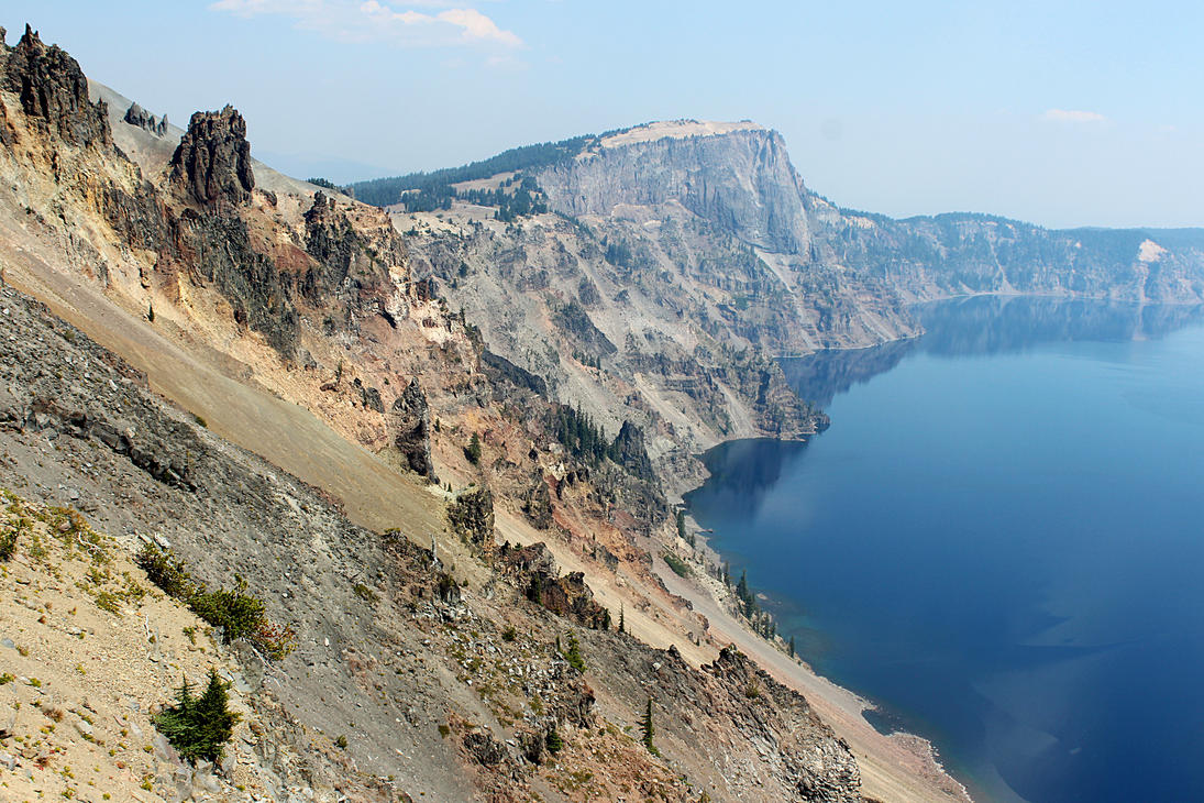
You'll drive around the crater, take the hikes, have the experience, etc. It's gorgeous and worth spending most of a day on. If you want, you can take a boat tour out to Wizard Island, out in the lake, but I've never seen the point: it's a pretty desolate place, and the idea of getting up early in the morning to take a steep hike to take a boat ride so I can be stuck on what is, after all, basically a desolate island for several hours never really appealed to me. But enough other people disagree with me that the option exists.
Breakfast: Grab something in Ashland. There's plenty of good, tasty hippie food, but I myself have a soft spot for The Breadboard.
Lunch/Dinner/Booze: Pack food with you: options are going to be very limited. There's a few crappy, overpriced restaurants (government-sponsored monopolies FTW!) inside the park, and you can get a beer, but I'd suggest bringing anything you want to eat or drink with you so you can save money and have decent-tasting things.
Where to Stay: Camp! Really, make a reservation in advance. Do it right now: don't plan on finding a fall-back hotel, because if you're unlucky enough to not be able to find a campsite, then finding a hotel is going to involve an unpleasant amount of driving. If you really don't want to camp, then make hotel plans far in advance, too (Klamath Falls is probably your best bet, though there are other, closer, more-likely-to-be-booked-already possibilities).
Total Driving Today: only 75 miles (1.5 hours). Note that, from Ashland, there are two obvious ways to get to Crater Lake; time-wise, it's a wash, but the route that passes by Lake of the Woods is much prettier than the route that passes through Medford, a depressing little heat trap full of cockroaches and meth. Do yourself a favor and skip Medford.
Detour: go through Klamath Falls

This is a pretty drive and gets you a chance to have a geo-powered beer at lunch in addition to seeing a location from the Fallout series. You'll see (non-threatening-to-you) real Oregon poverty, which (of course) is set in a place disproportionately high in Indians and veterans. Most of the poorest counties in Oregon put up signs all over about honoring veterans,
because honoring them (or putting up signs claiming that you do) is cheaper than actually supporting them. Similarly, Indians are honored
or memorialized
through museums and other historically oriented displays, which is cheaper than providing any kind of real justice.
Lunch: I'd recommend Klamath Basin Brewing Company.
Where to Stay: If you're trying to stay in Klamath Falls, I'd grab some hotel. (There is probably camping around, but I've never tried.) Try to book in advance, since there'll be a fair number of Crater Lake visitors. Or move on to Crater Lake and stay there, with the same caveats. If you cannot get a campsite at Crater Lake, Klamath Falls is the most likely (but not the closest) fall-back option; it's worth checking to see if you can't find someplace closer before you fall back this far.
Additional driving: 30 miles (40 minutes). Note that, yes, the route does in fact take you across Dead Indian Memorial Road
, which is the slightly sanitized version of the former name for the route: it adds the word memorial
.
Optional (but not recommended): Medford/Gold Hill/Jacksonville

I lived around here for two years and genuinely have very little to recommend that you do in this area. There are, however, some nice outdoorsy things, which is the only reason you might even consider this side trip. Table Rock is a nice, quickish hike not far out of Medford if you really need a leg-stretch; you might also think about Roxy Anne Peak for a similar afternoon hike. In general, there's plenty of parks and outdoorsy stuff, usually with a methy and/or libertarian redneck twist. If you happen to have bicycles with you, the Bear Creek Greenway runs from (at least) Ashland to north of Medford (20+ miles) and is a non-challenging, pretty ride, but I'd be surprised if you could easily rent bicycles nearby. (Though I haven't checked.)
The Oregon Vortex (House of Mystery) is perhaps worth a tour (playing spot the logical flaw
in their rather well-developed patter is kind of fun); expect to add about 20 minutes of driving to get there, plus an hour or so for the tour.
The area is pretty, and you can camp, etc., but (speaking as someone who lived within 40 miles of Medford for three years) the ignorant, self-righteous redneckery can get old really fast. (Historic
) Jacksonville is a cute town a short drive from Medford, an object lesson in what happens when the (now-former) county seat (of Jackson County, of course) decides not to bribe the railroad to come through. For some reason, people around here love to seize on any pretext to tell you that it's also the home of B-list horror movie actor Bruce Campbell (Evil Dead, etc.); I suspect that this is their way of proving to themselves that their existence has been validated by someone who has life options and is clearly not merely trapped in the area's endless cycle of poverty, self-righteous redneckery, and early pregnancy. If you're skipping Crater Lake for some reason (don't! not unless you have no choice!), Jacksonville might have some of your better lunch options on your way up I-5.
Food/Booze: Don't go out of your way to visit any of the local breweries. The Jacksonville Inn (if you go to Jacksonville) has decent food, and I fondly remember Donut Country (Medford; it's a bakery) and El Kora (Mexican food, Medford) for their overwhelming (and unusual for the area) culinary competence.
Where to Stay: This is definitely not a recommended overnight stop (it's not even a recommended detour), though there are various hotel options around here. Save money and just find the cheapest thing you can stomach; prices are relatively low in this part of the state. If you want to camp, which is arguably one of the only halfway good reasons to stop in this part of the state, Medford/Gold Hill KOA (actually in Gold Hill) is a good bet—there are other options, though, and looking around will pay off if you really insist on stopping around here (not recommended). Like with any campgrounds around here, though, you're likely to be surrounded by self-righteous rednecks in huge trailers who blare music of the Against the Wind
variety when they wake up at 6:30 in the morning to cook breakfast, but scream at anyone who violates their entitlement to complete silence after their children go to bed.
Additional driving: If you just want to visit the Vortex, which is the the furthest-out-of-the-way place mentioned, and then move on to Crater Lake: you're adding approx. 30 miles (30 minutes) of driving one way, and if you don't backtrack, you're getting a much uglier drive to Crater Lake.
Day 5 (Tue): Crater Lake to Portland

You'll have a pretty drive here; I recommend making sure you come into Eugene via Hwy 58, because (a) the drive along the river is much nicer than the plausible alternative, and (b) it's the faster route (assuming, as always on Oregon highways, you're not unlucky with construction, accidents, or slack-jawed yokels piloting an RV for the first time while yelling JAYSUS TAKE THE WHEEEEEEL
). There are plenty of miscellaneous places to stop along that route if you want to have a picnic/swim in a river; those options largely dry up by the time you hit Eugene, though.
Breakfast: If you didn't plan ahead and bring it with you, you'll have to do without or get some overpriced, mediocre food from one of the restaurants in Crater Lake National Park.
Lunch: The Cannery (Eugene) is a very tasty sandwich place (good tap list, too). The Bier Stein (Eugene) is also a good sandwich/beer tap house (but not as good as The Cannery). If you just want to grab a quick bite, the local Burrito Boy chain is quite good.
Dinner: See Portland.
Booze: Viking Braggot (Eugene) makes, well, braggots; though I wish they were a bit more honey-forward and less obviously near neighbors of beer. Still, they're quite delicious, and Viking often has a good food truck outside. Ninkasi is also in Eugene (alas, I've never yet made it, but I approve of their beer). Stammtisch (Eugene) has a good selection of German beers if you're in the mood for that. Locals who apparently don't know anything about beer and/or think local pride is more important than taste are wowed by Falling Sky, and yeah, sure, they're fine, but I wouldn't go out of my way for them.
On your way out of Eugene, unless you've developed a hatred of excellent Belgian beers, think about stopping at Agrarian Ales (Coburg, which is not far away; their beer is quite good and if you're not in a huge hurry, it's absolutely worth the extra 7 miles and 15 minutes that the detour will add to the day's drive). As you pass just east of Corvallis, think about pulling off and making a stop at Nectar Creek Mead and 2 Towns Ciderhouse: either is worth a stop on its own, and they're in the same industrial park, basically right next to each other, and all you really have to do to get to that industrial park is to pull off the freeway. Both are delicious and have super-nice people behind the counter.
Where to Stay: See Portland, below.
Total Driving Today: 235 miles (4.5 hours). (Route.)
Detour: take an extra day and see Eugene


If you're stir-crazy from being in the car, this is a decent stop, and Eugene can be a fun town; but it's more provincial than it tends to think it is, and you're only two hours from Portland, which really is a more fun place to be. All in all, I recommend treating Eugene as a lunch stop unless you have friends there or you've discovered something in your own research that constitutes a compelling reason for you to turn it into a stop. (Alas, this is yet another place in a three-week itinerary where a good city gets eclipsed by other opportunities.)
Eugene is quite a green city in the grand tradition of the larger Pacific Northwest cities whose populations don't engage in disproportionate indiscriminate sibling-fucking, so there's lots of green spaces in town. Skinner's Butte is a good quick hike with a nice view from the top; it's both downtown and along the Willamette River (combining these two things effectively is one of many city-planning things that Eugene does quite well). The river has an intermittent green belt along both banks that's worth walking in, and there are several footbridges connecting both sides (yes, this implies correctly that you can walk back downtown fairly easily from the Valley River Mall, which may be of interest if you're staying at the Valley River Inn). Amazon Park and Hendricks Park are also quite nice. There is culturey stuff to do if you want that, but they're not the best options you'll find on the trip: if you find you're trying to stretch out your stay in Eugene by looking for this kind of stuff, just drive north for two hours to get to Portland.
Breakfast: You can get good coffee and pastries around the 5th Street Public Market, which is iconic. Off the Waffle (2 Eugene locations, plus one in Portland) has a delicious quick (and pretty cheap) breakfast. Eugene also has a notable farmer's market (though only on Saturdays, so if you're following this schedule, you'll miss it; but it's worth a visit if you wind up in Eugene on Saturday).
Dinner: There's decent food, but not much will blow you away compared to what you'll get in Portland and Seattle. Check your favorite online review site. The problem with asking locals is that many of them are stoners who think their local pride is a substitute for good taste: it's not that you can't get good advice from locals, but rather that you have to be careful about who the local providing the advice is. It's the classic small-town (though not by Oregon standards) Napoleon-complex problem, only applied to dining on a citywide level.
Where to Stay: If you're staying in Eugene, get a cheap, clean hotel in the downtown area. I've been happy before (several times across two decades, in fact) at the Timbers Motel, which is near everything, but there are plenty of other, similar options. A noteworthy option, perhaps, is the Valley River Inn, near one of the state's larger malls (though being one of Oregon's larger malls is a bit like understanding science better than most Americans). It's a funky old place that seems to have conceptualized itself as a faux ski lodge in the 1960s, but the rooms are modern and there is wi-fi, and it's a good location to get in and out of from the Interstate, and is relatively convenient to downtown. Alas, their signage, as of November 2016, promised an upcoming make-over, which is kind of sad.
Extra Driving: None; you're passing through Eugene already.
Detour: take an extra day and see Bend


A big chunk of the reason to come through here is to see and interact with the landscape, with is beautiful in many different ways. Think hard about camping if you take this detour. Beyond that, Newberry Volcanic Monument is supposed to be gorgeous. The Deschutes National Forest is nearby; Tumalo Falls is one of the better stops. On your way out of Bend, you'll pass through the Three Sisters wilderness (the eponymous sisters are mountains), which is beautiful and contains lots of hiking and camping spots. There are also plenty of specialized tours available if you want to spend a day taking specially organized outdoorsy tours.
There are some museums; the High Desert Museum (you're 3,600 feet up) and Deschutes Historical Museum are not bad stops if you're feeling the local history itch or just need to get out of the summer heat for a couple of hours. On a related note, the nearby town of Sisters is a western-themed town: kind of touristy, but kind of a fun place for a quick stop.
Breakfast: I recommend the Victorian Café on your way out.
Lunch/Dinner: Spork is good. So is Broken Top Bottle Shop, which has tasty brewpub food. Three Creeks is a reasonable option, too.
Booze: Crux Fermentation Project is outstanding (and has good snacks). Boneyard Beer is pretty damn good (but, more than virtually everything else I mention on this itinerary, is perhaps most interesting to the IPA-lover). Three Creeks (mentioned as a dinner option) also has quite tasty beer. In order to package up their beer experience conveniently for tourists, Bend has conceptualized itself as an Ale Trail, and there are of course tours available: this is a town that gets a lot of its income from tourism.
Where to Stay: Camp! It's easy; it'll be warm in the summer, and there are lots of good spots. I'll vouch for Tumalo State Park. Or get a cheap hotel.
Additional driving: This heavily depends on exactly what you're doing and how you want to combine this with other parts of what's available and where you want to rejoin the main tour. If you take this stop, you can get to Eugene via Hwy 20 and Hwy 126, then head north up the Interstate; or you can head straight for Portland. Eugene is a fun little town, slightly bigger than SB, but heading straight for Portland from Bend has two advantages: it can shave off over an hour, and it brings you into Portland from the east, which is a pretty drive and cuts off almost half the driving required to take the optional Multnomah Falls stop if you do it along the way (totally plausible); I mention Multnomah Falls below as an option when you're in Portland (and it's totally worthwhile). Assuming you skip Eugene and Multnomah Falls on your way from Crater Lake to Portland, stopping in Bend only adds about 17 miles (45 minutes) of total driving on your way from Crater Lake to Portland. (Route.) If you add in Multnomah Falls, but skip Eugene, you're adding 45 miles (90 minutes). (Route.) If you visit Eugene on your way out of Bend, that adds 70 miles (just over an hour) to the amount of driving it would take to just head straight for Portland. (Route.) If you want to visit both Eugene and Multnomah Falls, I'd make Multnomah Falls an afternoon trip on a different day, because getting to Multnomah Falls efficiently from Eugene sends you straight through Portland anyway.
Detour: go see the Malheur National Forest
Really, this is pretty but probably a bigger delay than is worthwhile: you're headed east most of the way to Idaho. It's slightly less of a detour from Bend than from Crater Lake, but doing this from Bend really does make Eugene more driving than it's worth. Eugene being both more fun and closer to your main route than Malheur National Forest, I say this doesn't rise to the level of a recommended detour.
But Malheur National Forest is quite pretty, and it is, perhaps notably, the location of the gub'mint buildings taken over by those angry white hillbillies (er … patriotic, and brilliant yet unconventional, Constitutional scholars) last year.
Food/Booze: I'd pack it with you, or see what you can find in Burns or one of the other nearby towns. Good luck, yeesh.
Where to Stay: Camp! Or look for a hotel in one of the surrounding towns.
Additional driving: From Bend, skipping Eugene: 320 miles (6 hours). (Route.) From Crater Lake, skipping both Bend and Eugene: 335 miles (6 hours). (Route.) Other combinations with other side-trips are possible but would add even more driving.
Days 6–7 (Wed–Thu): Portland


The best reasons to visit Portland, IMHO, involve its appreciation for individual weirdnesses, which showcase weirdos in many of their possible forms; its food/booze culture, which make this a really good place to stuff yourselves and get very drunk (er ... engage in a detached theoretical comparative evaluation of various kinds of booze while avoiding intoxication); and the green- and human-emphasizing urban planning, which make it an amazingly diverse city with constant surprises around every corner. Very few American cities reward wandering in the way that Portland does, so try to spend some time on foot getting from place to place if you can.
There's lots of naturey stuff to do without leaving town, for starters. Washington Park is one of the best inside-a-large-city large parks you will have the opportunity to see on this trip, and you can, should you choose, see the International Rose Test Garden (Portland is, after all, the rose city
) and/or the Oregon Zoo, both of which are in the park. On a smaller scale, the Lawrence Halprin-designed parks (Pettygrove Park, Lovejoy Fountain Park, Keller Fountain Park) are quite pretty downtown areas, and connected by shaded pedestrian walkways that maximally avoid vehicle traffic, and also put you downtown in the area of the quite recognizable Portlandia sculpture, the second-largest embossed copper sculpture in the U.S., after New York's Lady Liberty.
Or take a walk downtown along the Columbia River (that puts you in the McCall Waterfront Park) and look at all the different bridges that … well, bridge the two parts of town. (Portland is—deservedly, I think—proud of the many visually interesting bridges that connect its two geographical segments. If you want, you can bicycle across most—all?—of the bridges.) This will also give you a chance to see the Japanese American Historical Plaza (which has some very nice sculpture) with no real travel-time investment, since you're walking more or less right past it anyway. There's a beautiful pedestrian/bicycle pathway right along the river in Waterfront Park; this is a good afternoon bike ride if you have, or want to rent, bikes.
Or you could walk through Forest Park (also right on the river, slightly more NW than Waterfront Park; eight miles long, 5000+ acres, 70+ miles of trails). You can reportedly see a breathtaking view from an aerial tram ride (you'll pass right by it in your way into town if you approach from the south on I-5); it's less than $5 per person. If you want to check off a Guinness Book of World Records stop, Portland also apparently has the world's smallest park (it's less than a third of a square meter in size, and its dedication recognized it as the only leprechaun colony west of Ireland). It would be a shame not to mention the Japanese Garden, which is also gorgeous. People talk up The Grotto, which is in fact pretty, but for a city with this many free parks, paying to get into an upper-class Catholic sanctuary where you get smug commentary barked at you by a recording in an elevator seems like something worth passing on. (I've expressed my opinion in more detail on this one elsewhere.)
A highly recommended quick trip out of town to see more nature is Multnomah Falls: drive east on I-84 for little over half an hour (and notice how quickly you start to hear banjo music as the Portland metro area rapidly fades around you). You can easily combine this with another stop at the right-next-door Wahkeena Falls (also quite pretty). You could easily do both in three to four hours, including driving, and have a nice, mild hike for afternoon exercise; you could also stretch this into a more strenuous hike, if you want. Or if you want to get a little further out of town, Mt. Hood is best known for its extreme skiability in the winter, but it's also quite good for hiking and not all that far from Portland (you can get nearby in a little over an hour each way).
Don't miss Powell's City of Books (make sure you hit the main location; bring a pre-decided amount of cash and leave your credit and debit cards at your hotel so you're not tempted). Also, Mother Foucault's Bookshop is quirky and quite amazing for the size (when I was last there, they were expanding, but I don't expect that their basic awesomeness has changed just because they have more space). OMSI is nice if you feel like a technical museum. Portland has all the sullen belligerence of the maybe Seattle is bigger, but we're a real city too and totally have culture
mindset, but they absolutely back up their claims; and so things like art museums and symphonies are worth doing if that's what you're in the mood for. (But San Francisco does all of these things better, to be honest; and I've written some good museum recommendations for you during that part of the trip.) Still, if you're feeling museum-y during this part of the trip, the Portland Art Museum is supposed to be excellent, and the Oregon Jewish Museum and Center for Holocaust Education is the largest of its kind in the U.S. The Shanghai Tunnels are supposed to be worth seeing, but I myself have never managed to get the timing right; plan ahead if that interests you, because the tours usually only happen twice a week or so.
Portland's Saturday Market is a fun artsy stroll, but … yanno, only on Saturday, unless you're there the weekend before Xmas (in which case it becomes what they call The Festival of the Last Minute
).
Portland is also famous for having one of the highest ratios of strip clubs to people in the US, in part because Oregon's constitution has broad free speech protections and case law based on that has consistently interpreted nudity and exotic dancing as protected expression. I have little experience here, but friends recommend Mary's for a low-key, welcoming, more bar-like experience and Hawthorne Strip, which they say is a relaxed neighborhood-bar type place. Acropolis Steakhouse is also a restaurant that serves, among other things, steaks from cattle the owner has specifically raised to be served as steaks in the strip club; Casa Diablo, on the other hand, bills itself as the world's first vegan strip club
and, deservedly or not, has the reputation of being the place where you want your bachelor party to end up if you're willing to spend enough money, nudge nudge, wink wink. Other recommended places when I reached out to friends to ask for recommendations include Union Jack's, which is just down the block from the Eastside Lodge, which I mention below as a plausible downtownish place to stay; and the Kit Kat Club, which is known for their nerdgasm
days. More than one friend specifically told me to warn you away from the Golden Dragon, apparently quite a disappointment due to the no booze
and allowing 18-to-21s
policies and their reputation as a training wheels
strip club for undergraduates.
Breakfast: Voodoo Donuts is famous for the eclecticism of their donut toppings (and it is also a wedding chapel), but the lines tend to make it not worthwhile (try hitting the original location late at night instead of for breakfast if you go, perhaps after getting sloshed at Kelly's Olympian, nearby; if you pass by earlier in the day, get a photo of the two of you at the famous Keep Portland Weird
sign on the side of a building right across the street). If you want donuts, Pip's Original and Blue Star are also fantastic, but without the outrageous lines that Voodoo Donuts has. Mother's Bistro has a very nice semi-upscale breakfast that's totally worth a short wait if necessary. Tasty N' Sons is supposed to have one of the best brunches ever (I haven't been myself, though). For coffee, local Stumptown was purchased a few years ago (by Peets, no less), so it's lost its hipster cachet; reportedly, Nossa Familia is the new hipster-acclaimed coffee shop.
Lunch: Portland is a real foodie city and there is good food everywhere. Notably, Portland might love its food trucks more than any other city I've ever seen: they really are all over. If you just want a place where you can go see a good set of trucky options, head to the two-block area near 10th and Alder (right downtown); or check the 1200 block of SE Hawthorne; or visit FoodCartsPortland.com; or just Google Portland best food trucks. Plenty of brewpubs are good for lunch too (notably Ex Novo: there's a reason why they're the brewery pictured in this article). On a different tack, as mentioned above, Oregon's high number of strip clubs makes some of them plausible lunch locations, such as the Acropolis, though they're not the only Portland strip club that serves steak.
Dinner: Again, Portland is a foodie city, and there's a huge number of rapidly changing options; check with a local for advice (Portland locals are pickier than the locals mentioned in connection with Eugene) or check your online reviews. Especially worth mentioning is Pok Pok (fantastic [optionally really spicy] Thai); get a reservation in advance, or plan to fall back to their sister restaurant, Pok Pok Noi. If you're in the mood for fine dining, the appropriately named Le Pigeon will serve you pigeon pie (when was the last time you had that?) or any of a number of other tasty things.
Booze: Portland definitely has the highest ratio of good brews to population on the west coast. Like much of the Pacific Northwest, the strongest payoffs are in IPAs, but there are definitely excellent payoffs in non-hoppy styles, as well (I have excluded breweries that only shine in the IPA style, so the non-hop lover in the couple need not worry about being left out.) There are three absolute must-visit breweries, to my mind:
- Ecliptic Brewery has a space theme that's a bonus, but not the payoff. If they're brewing their Hypernova again this summer, then (a) that means it's a seasonal summer beer, which might help me plan future vacations, and (b) you'll notice that it is probably the best IPA you've ever consumed. (Howevery, everything they brew in any style is fantastic; this is not just an IPA brewery.)
- Ex Novo Brewing is especially worth visiting for their dark beers—you will probably not find a better barleywine anywhere than their Nevermore— and they have very good pub food, too.
- Hair of the Dog is especially notable for continental Euro beer styles.
All three are all-around delicious and have a wide and impressive brew menu outside of the styles I mentioned, though: if you don't visit all of them, you fucked up.
Other notable booze in Portland:
- Breweries:
The Commons has wonderful Belgian-style ales.Update: they're closed.- Breakside Brewery has complex, multi-layered IPAs whose hoppiness is often floral rather than bitter and does a good job of pushing the
what IPAs can be
envelope in pleasantly surprising ways. - Belmont Station is a bottle shop with the highest great-beers-to-square-footage ratio anywhere (stock up at the bottle shop; have a beer at the tap house).
- Cascade Brewing has an excellent set of sour beers. You can get some of them in SB, but if you do, you have to get quite sour beers in 750 mL bottles that are much more expensive than they are at the tap room. Being able to get a tray of samples smaller than 750mL is a nice option to have for sampling their (very tasty) sour beer.
- If you want to soak in a saltwater pool ($5/person/hour) while having a beer, the Kennedy School (a bar that's a converted classic building … guess what it used to be) has a soaking pool (I'm not a huge fan of the McMenamins chain, but neither are their beers terrible).
- Cider and mead:
- Bushwhacker Cider is a very good cider/mead tap house with wide stylistic range in those drinks.
- Reverend Nat's Hard Cider is certainly the best-known cider house in Portland, and deservedly so; you can get the occasional bottle around where we live, but their tap house has a lot more to offer.
- Oregon Mead & Cider Co. (formerly
Stung
) has a tap room here; I have never visited it but quite like their mead. - The Mead Market will sell you bottles to take away, and they have (if I recall correctly) three taps or so from which you can get a sample.
- Things distilled:
- Kelly's Olympian is a dive bar with good cocktails, fast service, and no bullshit; their live-music scene is also impressive.
- The Sapphire Hotel has outstanding, brilliant cocktails (and, supposedly, fantastic food, though I've never tried it).
- Never have I seen a spirits list that is so fairly described as
an exhaustive collection
as at The Multnomah Whiskey Library. It's primarily for members, but if there aren't a lot of members, they'll let pleebs in. While you wait, you can drink downstairs at their other bar, whose selection is merely very very very good. - The Alibi is a fun little tiki bar that can be refreshing if pretentious serious booze conversations involving detailed critiques start to grate on you.
- If you feel like really getting trashed, a walk down the so-called Distillery Row (not an actual single street) is supposed to do the job (though I myself have never done this).
Where to Stay: Economize on a cheap-but-comfortable hotel somewhere near downtown. (Public transit can get you to the burbs, but it's less convenient than you might like. Getting to the burbs via taxi/Lyft/Uber will get expensive fast, and is slower than it should be. Portland is not a particularly tough town to find parking in, but if you're sober enough to drive around as a primary mode of transportation for most of the time during your visit, you're doing Portland wrong.) Xenia and I have had good luck with the nothing-special, reasonably priced Eastside Lodge, which is comfortable and secure despite not being in the absolute best part of Portland, and it is plausible walking distance from much of downtown. There are many many other options, though. Generally speaking, being north/east of the Willamette River is a good economizing move if you're still close enough to the things you want to do. If you want to stay somewhere unusual, the Kennedy School is, on top of being a pub owned by the McMenamins chain, and a converted school, a hotel.
Total driving: If you're doing Portland right, you should be drinking too much to get around by car.
Day 8 (Fri): Portland to Seattle

Optional stops: There's stuff around, but there's no genuinely compelling reason to stop, so unless your own research turns something up that's right up your alley, I'd recommend just moving on to Seattle and taking advantage of what it has to offer. If you want, you could theoretically take the detour for the abandoned nuclear plant at this point instead of on day 12, but it's a little further out of your way at this point. (It is absolutely a worthwhile stop, however, and if you find yourself perky early in the morning, then this is not a bad time to take it.)
You will in fact pass the sign indicating that you're crossing the 45th parallel, and it's a pretty drive, and it goes quickly. But oh man, do you pass through a Jesusy part of Oregon in between its two largest cities on Interstate 5. Keep movin'.
Total driving: 173 miles (about 3 hours). (Route.)
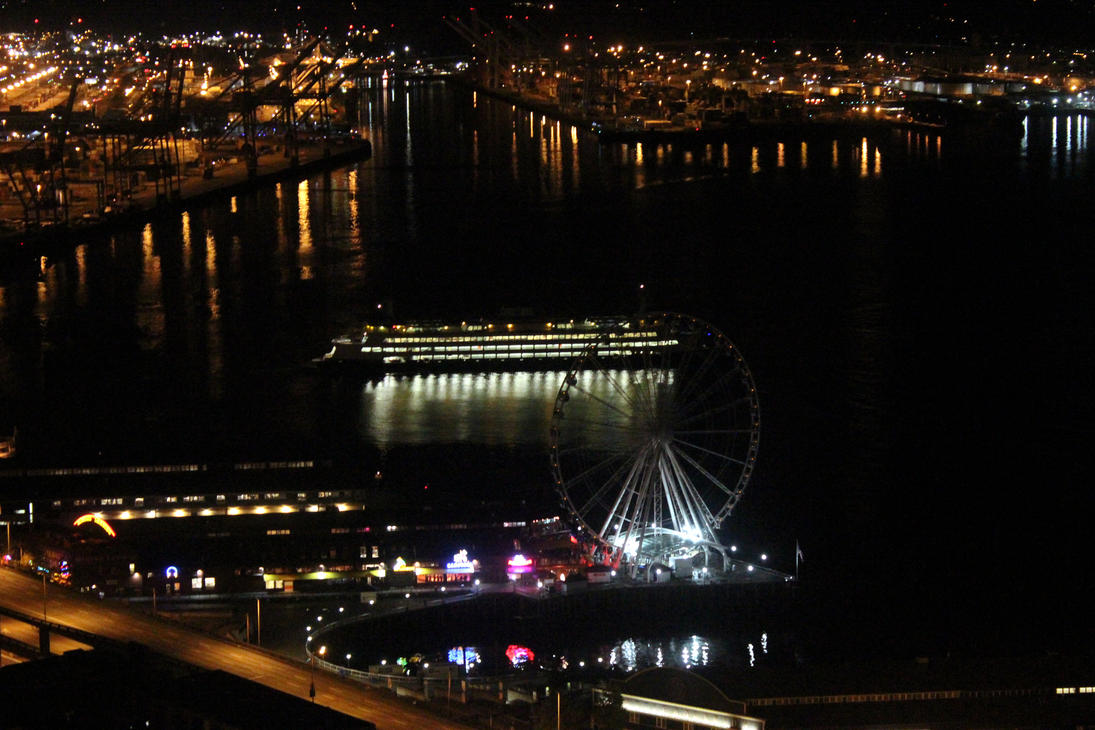
Days 9–10 (Sat–Sun): Seattle

I recommend staying in or around the Belltown part of Seattle; there are reasonably priced hotels, and you'll be near a lot of things worth doing, and a lot more of the things you'll want to do will be within walking distance. (This is the only part of town in which I've ever stayed at a hotel, to be honest, and it's always worked out well; but there are of course other options.)
The Museum of Pop Culture has really fantastic exhibits. The Space Needle is of course Seattle's most recognizable landmark; it's not cheap to get into, but is a fun trip up and has a gorgeous view. (You'll have to decide for yourselves whether that's worth $22 a pop and a long line to get up.) The permanent Dale Chihuly exhibition (literally right next to the Space Needle) is great if you like (or have never seen) Chihuly's rather unusual glassblowing. Bill Speidel's Underground Tours are a lot of fun and will get you some exercise and a nice pop-history lecture that talks some about sexual practices in the nineteenth century. The Seattle Art Museum is supposed to be good (though, sadly, I've never been). The Official Bad Art Museum of Art (the awkward phrasing is chosen, I suspect, to fit a pre-decided acronym) is also supposed to be worth visiting.
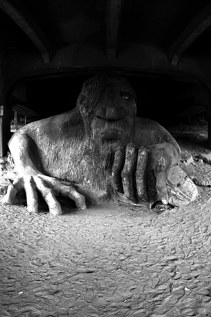
Do see the Fremont Troll, and wander around Fremont in general, paying attention to the sculptures, decorations, and other public art. (Check to see if Lenin's hand is currently red, too.) Kerry Park has a gorgeous view: go see it. It's possible to walk down by the waterfront, and you're only a few hundred feet from the bay at the Pike Place Market (though it's basically inaccessible from there because there's a freeway in between). Gas Works Park is a weird remnant of … well, an old gas works; but it's a hilly place overlooking Lake Union, and turned into something weird and kind of glorious that will appeal to the steampunk impulse in everyone.
There are lots of quirky special-topic museums that I've never seen; check your favorite online sources.
If you plan on stocking up on (ahem) edibles, Seattle is the best place to do so: they're legal under Oregon law as well, but Oregon has more restrictive daily purchasing limits on edibles (though not, oddly, on smokables) than Washington does. Seattle, too, has a better selection of shops than anywhere else you're going to visit in Washington.
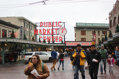
Breakfast: Ludi's (Belltown) has great, fast diner food. Pike Place Public Market has lots of good options, but for fuck's sake, don't miss Piroshki, Piroshki. Grab some sweet pastries when you visit; on your way out of town, grab some savory ones to take for lunch. Biscuit Bitch has tasty foods and gives you the opportunity to watch uncomfortable interactions in which the names of the items on the menu give middle-aged white guys a pretext for saying bitch
to young restaurant-working women. 5 Spot Has hearty tasty diner food.
Lunch/Dinner: If you're at the top of the Space Needle anyway, there's a restaurant up there; it is of course overpriced for what you get and you've already paid and waited in line to be there, but you can't beat the view. Umi Sake house (Belltown) has fantastic sushi. If you're staying at (or near) the Moore Hotel, it has an attached bar/kitchen, The James Moore, which is pretty good, has quick service, and is reasonably priced. Radiator Whiskey is supposed to have very good food. Windy City Pie has excellent pizza. Falafel King is a pretty good grab-some-food-to-go place in Belltown.
Booze: You must visit Holy Mountain Brewing, which has can't-miss beer that especially shines in the wild and sour areas but is all-around great, and does a wonderful job with their black metal theme; really, get out to this location.
Other booze worth mentioning that I've encountered:
- Beer:
- Cloudburst Brewing is very good and right by Pike Place Market (and, uh, they do a fantastic job naming their beers, though that's just icing on the cake).
- Fremont Brewing (Fremont district; try hard for this one) has so much good beer.
- Elysian Bar has pretty good food and a very good beer list (skip this one if you're beered out, though: their best stuff is widely available in California).
- The Knee-High Stocking Co. is a tiny (make reservations) speakeasy-style bar with incredible cocktails that's a plausible walk from Belltown.
- Cider:
- Schilling Ciderhouse has a good cider tap list (but don't bother with their own cider).
- Number 6 Cider is near Holy Mountain (a five-minute walk); I liked some of their cider, though Xenia disagrees. We do agree on skipping the brandy they distill from their cider, though.
- You really will want to stop at Finnriver on your way out of Seattle, but it's far enough away that you won't want to take the Bainbridge Island ferry to get to it during a day you're spending in the city.
- Distilled things:
- The Barrel Thief (Fremont district) is a wine/whiskey bar with a very large whiskey selection, pretty good snacks, and really, really good ideas about how to make cocktails. (This may very well be the first place you've ever thought that squid ink in your cocktail turned out to be a good idea, for instance.)
- Montana is a divey cocktail bar with good ambiance and nicely divey neon, plus good cocktails.
- The Whisky Bar (Belltown) does have non-whisky things that are quite delicious, but their whiskey selection is of course their killer app (and their cocktails are quite delicious).
- Canon claims plausibly to have the western hemisphere's largest collection of spirits, and their cocktails are amazing.
- Batch 206 distillery is right near Holy Mountain and Number 6; they were decent but not spectacular on our visit (though we did come away with a bottle of whiskey you can try for yourself if you don't wait too long.)
Where to Stay: Xenia and I have been happy three separate times at the Moore Hotel, which is a funky, cool-looking old building; be specific about whether you expect your own bathroom. It's conveniently located (Belltown, so downtown; three blocks from Pike Place Public Market) and competitively priced. It's got a decent restaurant/cocktail bar attached on one side and pretty damn good coffee attached on the other. And there's a theater next door (The Moore
) that has an interesting variety of shows (though I've never made it). But if it's full or you want to stay somewhere else, you'll probably still have fun in Seattle.
Total driving for these days: Ideally, none: take public transit/Lyft/Uber as much as possible
Day 11 (Mon): Seattle to Port Angeles, WA
You've got a pretty drive today, plus an enjoyable ferry ride (which, of course, means a toll); there are a number of nice places to stop. The Bloedel Reserve on Bainbridge Island is definitely worth visiting; take a nice hike here, even if it's drizzling. Olympic National Park is a plausible stop towards the end of the day if you power through quickly, though it's perhaps a more plausible stop on the way out tomorrow. You'll note that the directions posted on the Hwy 101 signs here have it running east and west rather than north and south; when you drive through Port Angeles, you're at the furthest-north part of 101.
If you feel like extending your trip by taking a ferry to Canada, by the way, then Port Angeles is the place from which you'd do that.
Lunch: Didn't I tell you to take some Piroshki, Piroshki with you? Or scrounge something up on the island, which is a place where people totally live and therefore probably has food available.
Dinner: Options are limited, but Next Door Gastro Pub (Port Angeles) will get you something acceptable.
Booze: Finnriver Cidery is wonderful; we've poured some of what we brought back for you on our last trip there. Don't miss this place: plan your trip to get there before they close (which is unfortunately kind of early). Along the way, you'll pass the town of Poulsbo, WA, which has four breweries for its approximately 13,000 people; I figure this must be a record ratio; Xenia and I have had beers at Slippery Pig Brewing, which was good but not amazing.
Where to Stay: Some hotel, probably. We once stayed at the Royal Victorian (nothing special, but comfortable and reasonably priced). There are other options, none of which is likely to blow you away. Really, you're stopping in Port Angeles not because Port Angeles is wonderful (though it does have its charms), but because driving further west gets you into less-populated territory with much less in the way of hotel selection. There is camping around, both inside and outside of Olympic National Park; I myself have never done it, though.
Total driving today: 82 miles and a ferry ride (2.5 hours if you get lucky on the ferry timing). (Route.)
Day 12 (Tue): Port Angeles to Astoria, OR


The whole drive you're taking today is jaw-droppingly gorgeous (most of it is along the Strait of Juan de Fuca or the Pacific) and is totally worthwhile for that reason alone, even though it's slow; don't take a shortcut around this route unless you're in a huge hurry. Also, think about taking the Olympic National Park detour. If you get into Astoria early, think about driving the short drive out to Warrenton to see the wreck of the Peter Iredale (see below).
Kurt Cobain Riverfront Park (Aberdeen) is kind of chintzy (in the yes, there's a sculpture of an electric guitar on a pedestal
kind of way) but surprisingly heartwarming if you've got a soft spot for Nirvana; it's at the bridge mentioned in the last song from Nevermind (and yes: the bridge spans the Wishkah River; and yes: the banks are muddy). There are no bathrooms at the memorial, which may be disappointing if you stop here after a long drive without first making a bathroom stop, but if no one else is around, you can take pleasure, as I did, in pissing under the same bridge that Kurt likely pissed under more than once while gathering the personal experiences needed to write Nevermind. Presumably, there were no bathrooms under the bridge then, either.
Breakfast: Coffee and muffins in Port Angeles (Xenia and I have been happy with Bada Bean), then move on.
Lunch: Scrounge something along the way, or pack your lunch from Port Angeles; the towns you'll be passing through here are mostly quite small. If you wait for Aberdeen, the first decently sized town in a while, you'll be quite hungry, but you won't be blown away by their options, either.
Dinner: Reasonably: Fort George in Astoria, though there are other non-terrible options, both in Astoria and along the way.
Booze: All in Astoria: Don't miss Fort George (if it's June, get their seasonal Spruce Budd … and bring Xenia a growler). Buoy makes good beer that I've enjoyed, but I've never visited their tap room. Rogue also has a public house here, which I have never visited, partly because I dislike their appropriation of the word revolution
to refer to their sales practices and partly because their labor practices are reportedly terrible (you will note that their job application page currently explicitly says that Rogues are willing to shun titles and personal financial success in the pursuit of the greater good
without mentioning that the greater good
in question is pretty close to being isomorphic with the company's profit); that tap house is right on the water if you want to visit it anyway.
Where to Stay: I've been comfortable during a school trip at the run-down-but-has-a-cool-50s-sign-and-is-cozy Atomic Motel. Alternately, if you want to spend a bit more, the Commodore is a comfortable suite-style hotel two blocks from Fort George and a short walk from the nice waterside; there are pretty views of the town, too.
Total driving today: 241 miles (but almost 5 hours). (Route.)
Detour: Olympic National Park
I've never done this, but it's supposed to be gorgeous and quite possibly worth either an extra day (or one or more in/out stops as you drive past). You cannot, however, drive straight across it as an alternative to passing north of it: it has several entrances that don't connect on the inside.
Dinner/Breakfast/Booze: Pack it with you: you're camping.
Where to Stay: Camp in Olympic National Park, or stay in Port Angeles.
Total additional driving: Varies depending on how you do it and what you want to do; but you'll be passing right by the park, so some version of it could be done with minimal trouble.
Optional (minimal trouble): Abandoned nuclear plant
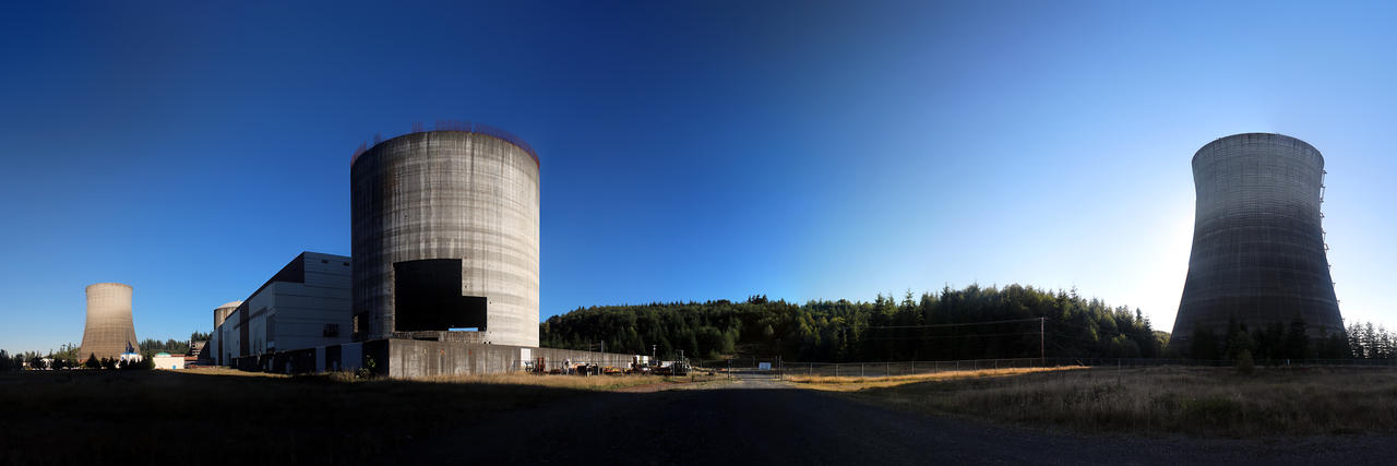
If you'd like, you can pull a short way off the highway to see a set of nuclear power plants that were constructed almost to completion before the money ran out. Now Satsop Business Park in Elma, Washington is trying to re-purpose the structures as part of a larger business park
idea, forgetting that every other small town that has ever tried to boost the local economy by creating low-tax business-friendly
zones in an isolated area with low property values has never yet attracted any businesses that are more than minimally economically viable or that employ more then twelve people. But coming here only adds half an hour of driving, and how often to you get to see a nuclear power plant that was constructed but never used?
Total additional driving: 30 miles (30 minutes). (Route.)
Day 13 (Wed): Astoria to Coos Bay (or Bandon)
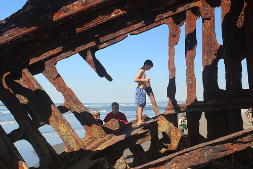

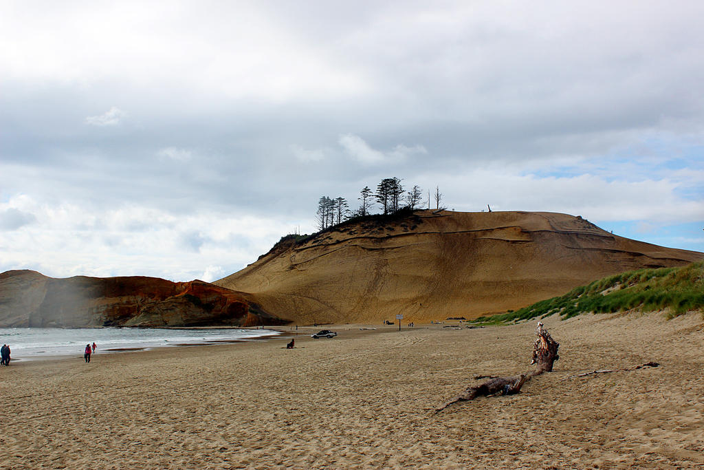
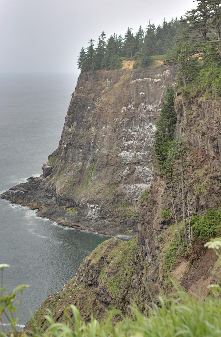


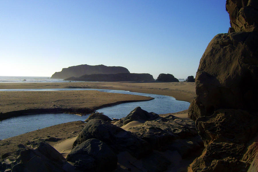
If you've got some extra time on your way out (i.e., if you're trying to delay your departure so you don't have to wait outside of de Garde Brewing looking like the kind of people who hang out outside breweries waiting for them to open), there's a twisted hunk of metal out at Fort Stevens State Park (Warrenton); it used to be the ship Peter Iredale, which did not quite make it from Mexico to Portland. You can walk up to the wreck at low tide, if you want; as a special bonus, you can often see the Darwinian spectacle of rednecks not paying attention to their children climbing on the ship's rusty metal skeleton. The beach is pretty, too, but you'll be seeing lots of gorgeous beaches for the next three days or so, and this beach isn't spectacular enough to pull you in, given what you're going to be passing right next to. The Astoria Column is a chintzy long high-modernist constructing-the-myths-of-Our-Town's-historical-glory painting mural around a column that's atop a hill; the column itself is not all that interesting, and the murals inside San Francisco's Coit Tower are a more interesting set of high modernist historical-myth murals in a tower; but the hill itself has a gorgeous view of the Columbia River emptying into the Pacific, plus much of the town. But you're probably better off getting your scenery along the way unless you're up early and actively trying to kill time.
The coast is the real star today, and you'll constantly be tempted to pull over at the many scenic viewpoints; if you just want to hit the best few, my personal favorites are Oswald East & Oswald West, and Cape Meares (which also has other reasons for stopping, which I'll talk about in a minute). (But pick your own places to stop, or just enjoy the view as you drive.) There are many gorgeous lighthouses along the coast, as well; if you just want to see one, I highly recommend Cape Meares (20 minutes out of your way), which is stunning, in a gorgeous location, with an additional opportunity to see the ancient so-called Octopus Tree without even changing parking lots. If you want to add a second lighthouse, I'd suggest the Coquille River lighthouse (which is in the town of Bandon, which sits on the mouth of the Coquille River; the town of Coquille, which shares its name with the river, is not on the beach. Conveniently, this lighthouse is in Bullards Beach State Park, where you could plausibly and quite enjoyably camp for the night) or the Umpqua Lighthouse (Reedsport, in Umpqua Lighthouse State Park, which also has camping, but holy Jeez is Reedsport a Jesusy place. I'm talking religious-tracts-in-restaurant-booths Jesusy, and they're extra-smug about it.) The South Slough National Estuarine Reserve (Coos Bay) is another wonderful spot for a hike with an unusual hybrid ecosystem that gives you a chance to see various unusual birds and plants, and it is stunning; it was also the first unit of the National Estuarine Research Reserve System, if that matters to you.
Cannon Beach (that's the name of a city) is worth a stop to see the ethereal beach at Haystack Rock (in the Cape Kiwanda State Natural Area), which you may recognize as a backdrop from The Goonies. This is a plausible snack/meal stop if you were dumb enough to skip eating in Astoria. The Oregon Dunes National Recreation Area (Florence) is probably the best place to stop and see part of Oregon's long coastal dune field, and is the place where Frank Herbert wandered while planning his novel Dune; there may be rednecks on ATVs, on the theory that a natural area is not worth having except insofar as it gives you an excuse to drag your redneck toys out onto it (you can rent ATVs right out on the dunes if you happen to feel the same way). It's often entirely deserted, though, and you can trip balls and wander around if you want. (However, stay above the water table—which is easy to determine, if you know how, and if you don't, well, the parking lot is way above the water table—unless you can identify quicksand; and make sure you're sober enough to leave by sunset, when they lock the gates). Right nearby is Darlingtonia State Natural Site, an unusual opportunity to see many of these carnivorous plants growing. Bullards Beach State Park (Bandon) is a plausible camping site and has a very pretty lighthouse, but it's not far from the highway and is worth a stop even if you're just driving through and don't mind paying a few bucks in day-use fees. Beach Loop Drive (Bandon) is right along the beach and is a short detour that keeps you right at the edge of the land when 101 veers slightly away; there are plenty of jaw-dropping viewpoints. It's a great place to watch a sunset, and Lord Bennett's restaurant and cocktail bar has a great view of the ocean, if you're looking for a meal with a view (several other decent-to-good restaurants in town have a good ocean view, too). Notable along Beach Loop is Face Rock, which is a particularly pretty view, but there are plenty of other good places to stop in here.
Museums and culture: Nope. Not much. Not around here. (There are local-history and special-topic-usually-of-the-boring-kind museums and some local community theater if you're really feeling the itch, but you'll have to dig.) You're not even going to pass many movie theaters today. Though if you want to see a movie, the Egyptian Theater (Coos Bay) is a gorgeous old building that has kept up its 1930s decor.
Breakfast: There's good coffee and good breakfast food in Astoria; I recommend Blue Scorcher Bakery & Café, or (especially if you stayed at the Commodore: it's on the same block) the Street 14 Café, which also has good food (the pancakes are especially worthwhile).
Lunch: When you start getting hungry and hit a decent-sized town, find something there, because most towns are not decent-sized (though you'll never go too long without being able to buy something plausible to eat).
Dinner: If you're running late-ish and find yourself still in Newport at dinnertime, Local Ocean Seafoods is fresh, tasty, and reasonably priced. Benetti's (Coos Bay) is the best Italian option you've seen in two days and is where the high-school locals take their prom dates if they can get reservations, though it's not so great that you should abandon something else you really want to eat for it. If you're camping at Shore Acres, outside of Coos Bay, think of driving out to one of the seafood restaurants in nearby Charleston. If you just want to pick up a dinner sandwich on your way out to Shore Acres, stop by Luigi's (Coos Bay's Empire District) for a sandwich, or Praus Haus for a burger (also Empire). If you're in Bandon, the best options are probably the Wheelhouse (or anything promising-looking in that old town
section, which changes more frequently than I go back) or Lord Bennett's.
Booze:
- Tillamook:
- de Garde: stop here if you possibly can. Try hard to arrange your schedule to match their opening hours, even though this will prevent you from leaving Astoria too early (treat yourself to a good breakfast in Astoria and/or go see the wreck of the Peter Iredale if necessary).
- Coos Bay/North Bend:
- The Captain's Cabin, downtown in the Tioga building, is a dive that's not only one of the places I visited on my 21st birthday, but is also on the ground floor of a building where I later lived. (Which is an explanation of why I have a fondness for this particular totally decent, but not spectacular, dive bar, as opposed to being an attempt to sell you on it.)
- Coney Station has a decent beer selection and food if you want to combine those two things.
- The Blue Moon is a diner/dive bar with live music on weekends; their beer list is not bad for the area, and (again) I can tell you stories about things that have happened there.
- Bandon:
- Lord Bennett's is reportedly a plausible cocktail option and sometimes has local live music (that's the first floor part of a second-floor restaurant mentioned as a plausible dinner option).
- The Crow's Nest has good cocktails (that's the second floor of the Wheelhouse restaurant, downtown, already mentioned as a plausible dinner option), or at least used to.
- The Arcade Tavern is a local dive that has beer.
- You might also think of driving up to the Bandon Dunes golf course somewhat north of town, or stopping there on the way in; if you spend money there, then your consumer experience will almost certainly depend, visibly or invisibly, on someone I went to high school with. They do have several decent bars on site at the dunes.
Where to Stay: Camping recommendations: Shore Acres (Charleston, outside of Coos Bay: highly recommended, though you'll sadly miss the surprisingly impressive annual Xmas lights display) or Bullards Beach (Bandon: gorgeous; the park is on the beach, and a notable lighthouse is right in the park).
If you feel like stretching this leg of the trip out, you might also plausibly camp/yurt at Jessie M. Honeyman State Park (just south of Florence) instead. It's right across the highway from the Oregon Dunes National Recreation Area. However, Florence has less to offer you for your evening than Coos Bay does; it has more than Bandon, but getting to Bandon gets you an additional 90 minutes of driving closer to the redwoods, which I tend to think is a good trade-off.
If you're not camping, just get a hotel room in Coos Bay (or Bandon, but there are fewer options there). There are scuzzy places around, so don't book thoughtlessly: look at the actual building or read online reviews.
Total driving: to Coos Bay: 231 miles (5.25 hours), including a toll when you cross the Golden Gate Bridge. (Route.) Bandon adds another 25 miles (25 minutes; just keep heading south on Hwy 101). Note that you could plausibly skip the coast entirely and head back to I-5, but you've already seen much of this section of I-5 on your way north, and it's nowhere near as pretty as the coast is. If your motivation is that you're trying to catch a play in Ashland that you couldn't catch on your way up, I'd cut over to I-5 from Bandon along Hwy 42, instead.
Day 14 (Thu): Bandon/Coos Bay to Jedediah Smith State Park/Patrick's Point/other redwoods camping


Again, the coast is the real star here; enjoy the drive and stop when you feel like stopping. The Bandon State Natural Area is quite gorgeous and worth a stop for a morning hike on the drive south out of town; you can of course also do other Bandon beach stuff before leaving, and you should if you didn't the day before. If it's hot and you're looking for a place to take a cold swim, you can drive up Floras Creek Road (south of the tiny town of Langlois, not long after you first depart in the morning); there are many likely spots.
You'll drive over Humbug Mountain (south of Port Orford), a beautiful series of hairpin curves where you'll have to watch out for suicidal bicyclists, most of whom are Californians; the route also gives you picnic opportunities. Port Orford's Battle Rock is pretty, though it is also the site of a memorial to the white settlers who pissed off the native people so badly that said settlers had to retreat to a defensible sometimes-attached sometimes-island until their reinforcements arrived. Prehistoric Gardens (also outside Port Orford) is a possibly worthwhile roadside attraction: concrete dinosaurs in the forest, and it's not too expensive to get into.
You'll be driving partway up US Hwy 199 if you head for Jed Smith State Park; don't go too far, lock your doors, and put your foot down on the gas if you hear banjos. This is your absolute last semi-good chance to get back to I-5 if you're trying to detour back to Ashland to match a performance's schedule, or to get back to southern Oregon in general; but if you waited this long, you're backtracking by heading northeast. (If you want to pass through Ashland on your way south, it would be better to head east from Bandon, then drive down Interstate 5 to Ashland; from then, you can either backtrack to Grants Pass and drive down Hwy 199—and if you do this, stop and grab a Borgia at Coffee Heaven in Cave Junction—or else take the slower route down I-5 and then cut back to the coast from Redding by going backwards through the Shasta-Trinity National Forest side trip.) All in all, I wouldn't recommend any of this as an alternative to just driving down the coast unless you're trying to deal with an unavoidable scheduling problem; the coast is the prettier and quicker drive.
Breakfast: The Pancake Mill (right off highway 101 in North Bend, which is just north of Coos Bay and nowhere near Bend) is a pretty good quick carby breakfast. If you're in more of a bistro mood, the Blue Heron (downtown Coos Bay) is good. Little Richard's (Coos Bay, right on highway 101) is decent diner food, or was when I was in high school, but I am banned for life and so haven't followed their fortunes. If you're in Bandon, try for the Bandon Baking Co. in Old Town. I wouldn't recommend trying to find decent breakfast in any other nearby cities without careful use of Internet review services.
Lunch: Scrounge it where you can via your favorite online review site, probably in the Gold Beach/Brookings/Crescent City corridor. (Outside of those cities, your pickings are not quite restricted to beef jerky and Dr Pepper, but there are far fewer diamonds in the rough than you might perhaps like for there to be.)
Dinner: Take food with you to camp with; if you cannot do this, there are a few hearty meaty lodge-style restaurants available, but cooking over a campfire is definitely the best option.
Where to Stay: Camp out in the redwoods if at all possible—make reservations in advance if you can. I'd recommend Jedediah Smith State Park if possible; I've camped there before and it's clean and comfortable and gorgeous. Patrick's Point (just north of Eureka) is a plausible alternative, though (if I recall correctly) it's near, rather than in, the redwoods.
Total Driving: Depends on exactly where you're stopping and ending, but Coos Bay to Jed Smith State Park is 131 miles (2.75 hours). (Route.)
Detour: Rogue River jet boat tours (Gold Beach, OR)
You can plausibly go upriver quite a ways in a jet-boat tour, and it's a gorgeous boat ride; if I recall correctly, there are several options that range in length from several hours to all day. Look into Jerry's Rogue Jets.
Extra Driving: None; how long you spend on the boat and how far you go depends on which tour you take.
Day 15 (Fri): Jedediah Smith State Park (or thereabouts) to Myers Flat (or thereabouts)
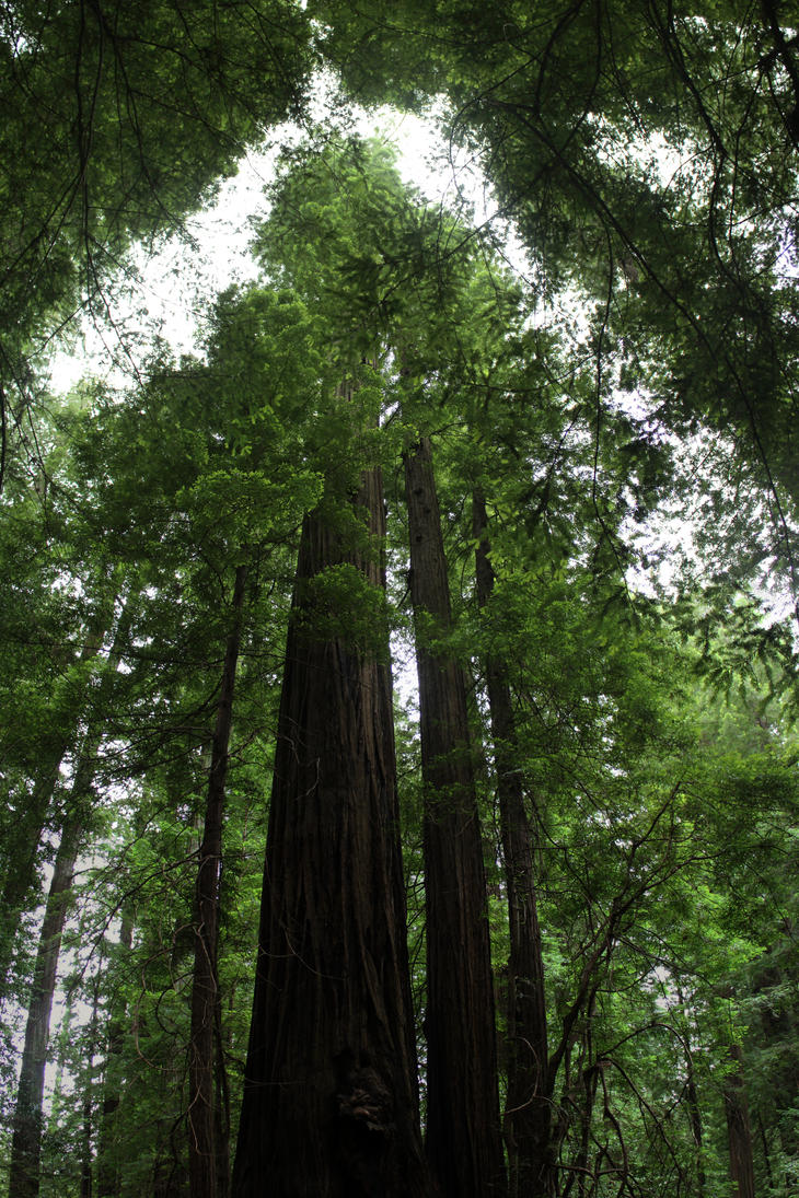
Once again, the coast is the real star on the first part of this drive (especially until shortly after Eureka), but it's a different coast than you've been seeing in Oregon: less lonely; less prominently geological; more obviously swimmable, especially if you're willing to cut glass with your nipples when you get out. After that, you'll have many redwoods to see, and you can (and should) take the easy detour along the so-called Avenue of the Giants (the eponymous Giants being, of course, the redwood trees), which is shady and well-maintained and gorgeous and not all that far out of your way.
Trees of Mystery (Klamath, CA, a short drive south of Crescent City) is another roadside attraction possibly worth a stop (the locals are inordinately proud of it, as you will be able to tell from their bumper stickers); even if you don't go in, you're going to drive right past it, anyway, so stop and take photos of each other in front of the giant, admission-free statues of Paul Bunyan and Babe the Blue Ox out front, right in the parking lot.
You'll see lots of little places to stop and find interesting souvenir-y knickknacks here; even if you don't feel like buying, stop and take a look at some of the weird stuff (chainsaw carvings are everywhere, for instance) that's for sale and on display. There are also several rather interesting roadside-attraction things, too, though I think that if you want to spend money on something, Trees of Mystery is your best bet.
If you're in a hurry and trying to make room for an extra day of something, one way to do so would just be to avoid stopping on this trip and make a full day of driving to San Francisco and pass through Humboldt County, skipping the rest of the NorCal coast, but there's a lot of fun little stuff in here if you dig. Alternately, if you don't want to go that far tonight but don't want to stop this early, you could move on to Willits, Ukiah, or Cloverdale (on Hwy 101) or Fort Bragg/Mendocino (Hwy 1). All of these have hotels, and there are camping options nearby for all of these places; I've been happy at the Cloverdale/Healdsburg KOA in the past, though there are plenty of other options.
Breakfast: If you didn't bring this with you, hightail it for Crescent City to get some mediocre food. Or wait until you get to Arcata and go to Renata's Creperie, which is fabulous and wonderful and, yes, absolutely worth waiting in line for. (If you absolutely cannot wait, Big Blue Café is also good.)
Lunch: Arcata/Eureka somewhere. Online reviews are your friend.
Dinner: Assuming you are in fact camping again, I'd pick something up in Eureka to take with you.
Booze: Lost Coast (Eureka) has good beer (and their food looks good), but I've never been to their taproom. There are people who really like Eel River (Fortuna), though I myself find them just pretty good.
Where to Stay: A second night in a row camping: this time at Myers Flat, which is on the edge of Humboldt Redwoods State Park (there are several nearby camping options). If you don't want to camp, then look carefully at your favorite online review site to find a hotel, because many of the towns you'll be passing through are tiny.
Total driving: 148 miles (2.75 hours). (Route.)
Detour: Mountains of the Shasta-Trinity National Forest
If you take this trip, you're essentially on a drive on twisty pretty mountain roads: perfectly safe and well-maintained, but kind of slow. It's absolutely worthwhile, since you're not actually crossing mountains all that much on this trip (I realize retroactively I've mostly routed you around them, though that wasn't intentional), and these are gorgeous (very-dry-in-the-summer) mountain and forest landscapes.
Breakfast: You will have grabbed this already.
Lunch: You can grab food in Arcata, or Mad River Brewing (Blue Lake) has reasonably good food and beer (and you'll be driving almost right by it). Or pack a lunch with you. Or hold out for Weaverville, the largest city you'll hit on this detour (Mama Llama has good coffee and food).
Dinner: If you're not camping out here, go back to Arcata or Eureka for this. If you are camping, head to Weaverville, or take food with you.
Booze: All I know about is Mad River Brewing (Blue Lake), which is good but not so good that it demands a stop.
Where to Stay: If you want to stay out here, there are several established campgrounds in the Shasta-Trinity national forest. The truth is, though, that most of the Forest Service land here is camping-OK, even outside of the many established campgrounds; I've done it on several occasions, and there are lots and lots of good camping places. Check with a ranger station for maps and recommendations (and get a fire permit if you're planning on having a fire or cooking on a camp stove).
Extra Driving: A round trip to Weaverville is 190 miles (4 hours). (Route.) You don't have to go that far if you don't want to, though, and there's a lot to be said for driving partway up here and finding a spot to camp.
Day 16 (Sat): Humboldt County to San Francisco

On your way out of Myers Flat, think about making a small detour through Leggett so you can stop at a nice redwood park (there's a small admission fee, and you can drive through a tree).
You're taking another drive through the hills; at this point, you're basically off the coast until you get to San Francisco unless you take the Hwy 1 detour written up below. But Hwy 101 is still pretty, and if you didn't take the detour along Hwy 299 suggested above, this is one of the few places you'll see much in the way of mountains on this trip.
Breakfast: There are plenty of nice places to stop for breakfast; Humboldt County has lots of good food. I myself like Renata's Creperie (Arcata; wait in line if you have to, because it's worth it, and the line, in my experience, moves fast). If you need a coffee top-off, stop at Plank Coffee (Cloverdale).
Lunch: I'd stop at one of the breweries mentioned below that has food.
Dinner: See below.
Booze: Lots along the way in here. Probably the best single stop is Russian River (Santa Rosa), but holy shit those lines (and, alas, this schedule has you going through on Saturday, which makes it much worse: don't be surprised if it takes you two hours in line to get to the hostess inside, who will then put you on the list for an open table, and they will text you in another hour or so). Still … if you want a damn good beer, this is by far the best in the area. (They also have food, and it's good though not remarkable.) Also worth mentioning are Lagunitas (Petaluma); Sonoma Cider and Bear Republic Brewing (both Healdsburg) are good, but much of their good stuff is available back in Santa Barbara.
Sonoma County is of course famous for its wine, but you should get recommendations from someone who knows wine better than I do if you want to chase that rabbit. Or just drive around and see what you can find using Sonoma County's website and/or your favorite online review sites.
Where to Stay: San Francisco or the East Bay; calling ahead for a reservation is highly recommended.
Total driving: 231 miles (3.75 hours). (Route.)
Detour: Take a detour down Hwy 1

Well, the drive is gorgeous, which is much of the point of detouring onto U.S. Hwy 1 in the first place. There are plenty of places to stop and gaze at the ocean, and plenty of little parks and preserves—many are worthwhile stops but none are (IMHO) so fantastic as to make me describe them as compelling. Perhaps notable is Bodega Bay; not only is it gorgeous, but was the setting for much of Hitchcock's The Birds.
Also see the optional Marin/Sonoma trip, below, if you want suggestions on the last leg of this trip; you might think especially about cruising through Point Reyes.
As far as art and culture goes: There's lots of little stuff in little- to medium-sized towns, but the large majority is the kind of self-righteous, inflated, smug identity-building art that's produced by low-talent trust fund babies who are trying to figure out what to do with all their time now that daddy's given them so much money that they don't ever have to work. However, there are diamonds in the rough, and if you want to spend some time here, digging will pay off.
A worthwhile low-effort architecture-viewing stop is the Marin County Civic Center (San Rafael; you'll see it briefly in passing as you drive down 101, but it's worth pulling off to see the outside and wander through), which was a politically contentious building in many ways; it was one of Frank Lloyd Wright's last designs and wasn't started until after his death. It's appeared as a backdrop in Gattaca, THX 1138, and a Dr. Dre video, and was the recording location for one of the Grateful Dead's less-impressive albums and for part of Frampton Comes Alive!, and was the inspiration for the architecture of Naboo in the Star Wars films. Anyway, it's a stunning late-modernist California hall, the largest of Wright's public projects, and you're basically driving right past it.
Lunch: Scrounge it where you can; your best bets are probably Fort Bragg and Mendocino.
Dinner: I'd pick something in SF (see below).
Booze: One good reason to take this route would be to visit North Coast Brewery, which I have never done; but they do make good beer and have a taproom in Fort Bragg. If you bail out early along Hwy 126, you might stop at Anderson Valley Brewing (Boonville); I have never been but their beer is (IMHO) decent, though not enough so to be the sole motivation for bailing off of Hwy 1 early.
Where to Stay: I'd recommend moving on to SF, instead.
Additional driving on this side trip: 35 miles (and 2.25 hours). (Route. There's still a toll on this route, because you're still crossing the Golden Gate Bridge.) But if you want to stop in Ukiah (on Hwy 101) or Healdsburg (on Hwy 126), you can bail out early along Hwy 126, which will save you 10 miles and 50 minutes of driving compared to the larger highway. (Route.)
Days 17–18 (Sun–Mon): San Francisco
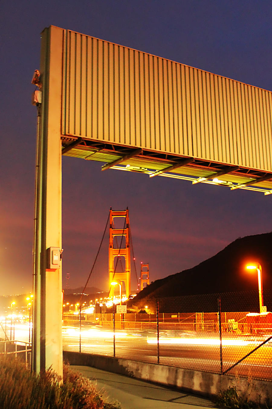
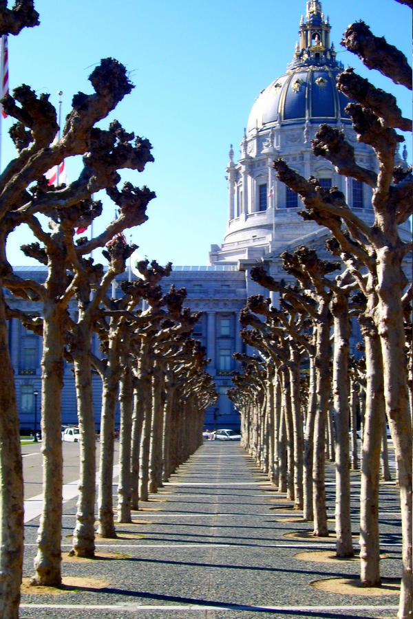


You'll come into the city via the Golden Gate Bridge. There's a good viewing point just before you get onto it, if you want to pull off; it's a great place to take a selfie at sunset, if you time it right. Some things you should know about bridges in San Francisco: getting into the city involves paying a toll (though that's sometimes waived late at night or on holidays), but they don't want poor people to be stuck in the city for lack of a few bucks, so getting out is free. Try really hard to avoid driving across bridges during the morning and evening commutes; they turn into miserable choke points that crawl at single-digit speeds for a couple of hours at a time.
Driving in SF is a particular kind of hell if you don't know your way around, even if you've driven in other hell cities. To begin with, there are lots of one-way streets; plus, the basic orientation grids rotate by somewhere around π⁄4 radians as you move from one part of the city to another. And there are long stretches of no-left-turn streets (nearly a mile at a time along some major arteries), especially during the day. Ticketing of parked cars is perhaps more predatory than anywhere else on the west coast, and parking is both scarce and outrageously expensive (when trying to find on-street parking, it is not uncommon to move in increasingly large spirals around your destination for up to an hour, or even more, while looking for a free curb slot). A substantial portion of locals are assholes who will put on their emergency blinkers to run into stores while they block lanes of traffic for ten or fifteen minutes at a time; they do this even when there is only effectively one traffic lane, and the general attitude for these people seems to be that if you don't like it, you can go fuck yourself or try to find your way around. (If you are driving, a good strategy is just to lean on your horn until the person who's blocking you stops being an asshole. Be judicious in your application of this rule, of course; but you won't be short on opportunities to apply it fairly.) The best way to deal with the driving-related problems is to try to group activities geographically when possible and rely on Lyft/Uber/public transit to get to clusters of things, or (as a last resort) taxis.
One good way to see a lot of SF quickly is to take a tourist bus tour; many of them have step on/step off privileges and/or two-story buses, and you might plausibly hit a lot of stuff on this list quickly in a day by doing so. Alternately, if you haven't been doing enough driving over the last two and a half weeks, there is a famous 49-mile drive that you can get your GPS to help you interpret; it is in fact quite a good tour around the city and can be done with selected stops in two to three hours (gods of traffic willing), and you can of course abandon it at any time. For a shorter drive through the city, Market Street is gorgeous; I'd take it late at night so you can avoid traffic and actually enjoy it (there's a great set of views of the city lights from atop a hill in the center of town).
There are lots of outdoor/nature things to do inside the city: Golden Gate Park (north end of the peninsula) is gorgeous; think about also visiting some of the museums inside the Park (the Conservatory of Flowers, the California Academy of Sciences, and/or (IMHO) the best option, the de Young Museum). There's a worthwhile Japanese tea garden and the rose garden inside the park, too. Heading west from anywhere will eventually take you to the beach: you've seen much more interesting beaches in the last week; but heading up/down the limited-access Highway 35 (the Great Highway
) is sometimes a pleasant drive to get from north to south or vice-versa on that side of the peninsula (though you're not likely to spend much time on the west side of the peninsula, to be honest). At the end of the Great Highway, before it turns into Geary, you're in the Lands End/Point Lobos quasi-natural area, which is pretty and contains two things I'll mention elsewhere: the Cliff House (bars/restaurants/resort) and the Legion of Honor (art museum). If you keep hugging the north cliff a bit more, you'll hit the Presidio, a similarly green area just south of the Golden Gate Bridge. Crissy [sic] Field and Fort Mason are in that area; both are absolutely worth taking a walk in and marveling at the views of the bridge. (And If you've developed a chubby for military history, you'll find some museums to rub it up against in this part of town.) Near the Embarcadero (in the NE part of the city), Coit Tower sits atop a hill that gives you a great view of the bridge, the East Bay, and much of the city; there are excellent modernist murals inside painted by WPA-employed artists during the Depression, and during the day, you can take an elevator up to the top of the tower for an even better view (there are lines and an admission charge, though), and even if it's closed for the night, you can drive up (this is the best time to park there, actually; if you go up during the day, take a bus or hike up from further down) and take a look around at the view, then look up at SF's brightly illuminated giant white cock with the interesting history that the tour hints at. Alcatraz Island is a fun trip but takes a serious chunk of a day and you need to book waaaaay in advance; if you can't do it or don't want to spend the time, you can instead take a harbor cruise around part of the bay (look for options around the Embarcadero or, failing that, Fisherman's Wharf). If you didn't see the gorgeous view of the Golden Gate Bridge from just north of the Golden Gate Bridge, you could do so now but the parking lot there is a pain during the day; expect a long wait (or you can walk across the GG Bridge with no toll if you want, or rent a bicycle to get across it). Alternately, if you want a good view of the bridge around sunset or at night (though probably not late at night), it might be worth exploring around the Fort Point/Crissy Field area, which also has fantastic views.
Especially good places for people-watching: museums, the financial district, Union Square, the Castro, the Haight.
Speaking of museums, you have far better options than you've had with the other cities on this itinerary, and you could absolutely spend a full day, or more, just visiting the best ones. I'd make sure to visit the MoMA (the E side of the peninsula), near the Bay Bridge; it is fabulous and just re-opened after a massive three-year-plus expansion), plus as many as possible of:
- Art:
- The Asian Art Museum (near city hall, NE part of the city; arguably walking distance from the MoMA);
- the Legion of Honor (within sight of the Golden Gate Bridge; good 18th/19th-century collections, including a huge collection of Rodin sculpture); and/or
- the de Young (in Golden Gate Park).
- Other worthwhile museums:
- The Contemporary Jewish Museum (E side of town: near the MoMA) is quite good;
- so is the Museum of the African Diaspora (in the South of Market district, NE part of town).
- The Musée Mécanique is truly charming, but it also doesn't hide the ugly parts of American culture that it's documenting; don't be surprised when you see gender and racial stereotypes embodied in some of the museum pieces.
- Museums that I haven't visited but that promise to be interesting:
- The Cartoon Art Museum (near the MoMA).
- The American Bookbinders' Museum (near the MoMA).
- The Antique Vibrator Museum.
- GLBT Historical Society Archives & Museum (Haight district, near good people-watching and shopping).
- Yerba Buena Center for the Arts (again, near the MoMA).
The Armory is a historical public building that's now used by kink.com as a studio; you can take a tour or a class if you'd like. Across the street, diagonally, is the Armory Club (only open evenings, but grab an excellent cocktail from here no matter what you do). On a related note, Wicked Grounds is a kink-themed coffeehouse; bring in a partner on a leash and get him/her a dog bowl of coffee, if you want to. City Lights Bookstore was a notable hub for the beat poets, and there's a beat museum that's fun, though not enough to motivate a detour if you're not already nearby. Mission Dolores is perhaps the most impressive and beautiful of the California Missions; it is of course the source of the name of the Mission district. Bawdy Storytelling is an opportunity to watch various empowered people talk about their sex lives with well-developed narratives. Audium is supposed to be an amazing experience; Xenia and I keep meaning to go.
Notable shopping includes the famous Good Vibrations (there are several locations, plus a location in Berkeley, if you take the East Bay trip). Doc Martens has two good locations in the city. There is also plenty of smug SF paraphernalia everywhere, and there's plenty of good thrifting around, especially in the Castro and on and near Haight St.
Breakfast: St. Francis Fountain (Mission district) has one of the city's more amazing diner-style breakfasts; expect to wait a half-hour on weekends, but it's worthwhile. The Pork Store Café has really good pancakes (and many other breakfast foods, for that matter). If you're in an eggs-and-beer mood, head to Magnolia (Haight St., NW part of the peninsula, near good people-watching and shopping, including one of the city's two Doc Martens stores). Try to get coffee at least once from one of the Ritual Coffee Roasters (best place to do this is in the Mission District) and/or Blue Bottle (best place to do this: at the top of the MoMA) coffee locations while you're here. Squat & Gobble (several locations) is not as good as it used to be, but they do have fantastic crepes and good rosemary potatoes. The Cliff House has several restaurants and bars inside the structure and a great view; there's a good Sunday brunch at at least one of those restaurants.
Lunch: Tommy's Joynt [sic] has really good pub-style sandwiches. There's good Mexican food all over the Mission district (and often elsewhere), which is a part of the city also worth seeing. (But people who tell you that the food from the weird cultists at Gracias Madre is delicious are fucking idiots. There is such a thing as delicious vegan Mexican food, but you won't find it there. They've also managed to piss off a great deal of what used to be their smug former clientele.) There's decent but pricey seafood in the Fisherman's Wharf area, though avoiding overpriced clam chowder in sourdough bowls requires some effort (I myself have had a good seafood dinner at Capurro's). On the other hand, maybe you want overpriced mediocre clam chowder in sourdough bowls, in which case, head over here and go face-down into whatever's being sold at the first place you see. Up in North Beach, the Stinking Rose is a garlic-forward restaurant that's supposedly worth a stop, though I've never been there. Yerba Buena Gardens (E part of the peninsula, right by the MoMA) is a pretty two-block park in a nice part of town where you can stretch out on the grass; there are decent places to grab something to eat nearby if you want to eat lunch in a park. Alternately, if you're feeling like a hike and a picnic, you might head up to Sutro Tower (center of the peninsula, in the Twin Peaks district) with something to eat so you can bask in all the radio waves and marvel at one of the landmarks most visible from much of the city (not to mention appreciate the incredible view of much of the city itself, especially from the north-facing end).
Dinner: Don't miss Dosa (either location; Fillmore is bigger and a nicer building, but make a reservation at either); it's certainly some of the best Indian food on the west coast, and the cocktails are outstanding. (And when you say you want something made spicy, they do not fuck around. You have been warned/advised/subtextually hinted.) Daigo is on the spendy side, though it is reasonable for having some of the most amazing sushi on the west coast; it's not all that near anything else you want much, but SF is geographically small and this is a good stop if you're on your way to the west end of the peninsula. If you want pizza, the best bet is Little Star (though there are other very good options). If you can get into the House of Prime Rib, more power to you; normally you need to make a reservation months in advance or call in a favor from someone in the hospitality industry (but if you get in, you'll see why). Dr. Teeth and the Electric Mayhem (yes, it's named after the band from The Muppets) is supposed to be a good bar/restaurant, but I've never quite gotten around to going. Truly Mediterranean (Mission) has excellent food, especially their falafel. Mission Pie (Mission, natch) does its one eponymous thing (not pizza) quite well. The Sheeba Piano Lounge (Fillmore district) is a piano lounge/Ethiopian restaurant with excellent food (and never mind the piano bit: the food is fantastic). Burma Superstar (Inner Richmond) is reportedly excellent, but incredibly popular and therefore virtually impossible to get into. In the true spirit of manufactured-differences capitalism, they've opened a similar still-good-but-not-as-good-but-easier-to-get-into Burmese restaurant next door, B Star: you might shoot for the better one, but treat the other as a fallback. Thai Idea (the Tenderloin) is, I shit you not, so tasty you won't even notice it's entirely vegetarian.
Booze:
- Breweries, etc.:
- 7 Stills (near Hunter's Point [SE part of town]; it's also a distillery) is very good, and they give a very nice tour that you can book in which they talk about their unusual distilling practices.
- Laughing Monk is almost right next door to 7 Stills and is also delicious.
- The SF Mead Company is totally worth visiting; they're friendly and (again) give an excellent tour.
- You should hit Mikkeler (financial district, NE part of town) if you can; they're delicious but pricey, and they also have hipster snackies.
- Magnolia (the Haight district) has specialty ales and gruits; you should really hit this if you can (they have a good Sunday brunch, too).
- Anchor Brewing has a location here that I've never visited.
- Cellarmaker (South of Market; NE part of town) has excellent dark beers, IPAs, and Belgian-style brews, plus generous tasters.
- People say good things about 21st Amendment, but I'm underwhelmed by their beer, food, and service.
- Skip ThirstyBear, too, unless
organic
is more important thantasty.
- Rogue has a tasting house in town, but come on: there are many better options that are actually local and that you can't get in SB, and the same problems I noted in relation to their Oregon location are still in force.
- Beer bars:
- Toronado is a very good tap house.
- Zeitgeist (the Mission) has good beer options and is kind of divey, but also notably has an outside smoking area, and I've wandered away with interesting stories (ask me about the time I got kicked out. Of the Zeitgeist).
- Better still is Noc Noc, which is filthy and grafittied and fun (and has a very good beer list).
- Cocktail bars:
- The Armory Club is owned by kink.com; you should have a cocktail here and soak in the décor and the people. (Really, don't miss this one.)
- ABV has good cocktails and pretty good snacks.
- Even better is The Alembic (the Haight), whose booze selection is extensive and whose cocktails are genuinely brilliant.
- Blackbird has innovative and brilliant and very well-executed cocktails
- Bourbon and Branch is speakeasy-themed and (again) has wonderful cocktails; I recommend you make a reservation for them or their similar next-door bar, Wilson & Wilson.
- Third Rail (the Dogpatch) will get you trashed on reasonably-priced-for-SF, very very tasty, quite strong cocktails.
- The Cliff House (Great Hwy & Geary) has good cocktails and a great view; food, too (Sunday brunch is impressive).
- Martuni's (a martini-themed gay bar with an incredibly long line for their one bathroom if it's at all busy) makes dozens of variations on the martini.
- Whitechapel (the Tenderloin) is a (very gin-forward) cocktail bar with hundreds of specialty cocktails, mostly gin, including a number of quite rare gin drinks of historical interest (Xenia and I spent New Year's Eve 2016 here).
- Rock Bar is comparatively cheap and divey (in a buckets-of-ice-in-the-urinal-trough kind of way), but it's fun and the cocktails are strong and cheap.
Where to Stay: This will (sorry) probably be your most expensive place to stay on the trip, and (sorry) there are no good camping alternatives that are actually close enough to SF to make commuting plausible. Try to find something reasonable with good transportation options to downtown. Getting around in SF is comparatively slow and/or expensive; public transport goes everywhere but buses are slow and BART only usefully covers the east side of the SF peninsula (you can totally spend three days only in BART-covered areas and not run out of things to do; and, in all fairness, BART also serves the function of connecting SF to the rest of the Bay).
Whatever you wind up doing, plan ahead and try to reserve something that's not outrageously expensive, ideally in the northeast part of the city (where you're more or less central to most of the things you'll want to do) or (failing that) within walking distance a BART station (other forms of public transit are much slower).
Wherever you make your reservation, ask explicitly if you will have parking: often, it's not guaranteed, or costs extra, or is not on site at the hotel, or has to be requested at the time you make your reservation. (Parking in SF is almost always a pain. Your hotel is not a Foucauldian heterotopia in this regard.)
You might also save some money by staying in the East Bay (see below for suggestions), which often makes staying near a BART station more plausible, and which eases the parking difficulty somewhat.
Detour: Quick East Bay trip
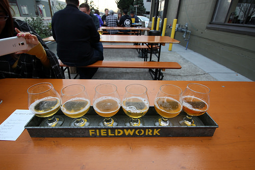
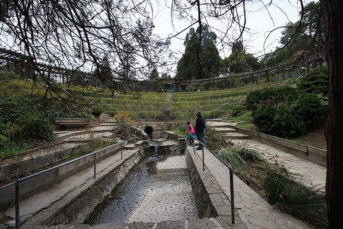


You could in theory combine this trip with the Hwy 1/Southwest Bay detour, depending on how much stuff you want to do on each side trip; that tour suggests Half Moon Bay and San Gregorio first, but there's no real reason not to go through it backwards (which would make more sense if you were starting in the East Bay) except that Gorilla BBQ (Pacifica) tends to run out of food early, because they're amazing; and missing them would be a sad thing.
You can go carless on this trip if you just want to BART to downtown Berkeley and stick around campus: there's absolutely a day's worth of stuff to do there if you want, and if you're happen to be trying to meet up with Rachel in Berkeley, that's probably more or less where you'll do so. Still, you'll actually be missing quite a bit if you don't see the non-BART-accessible parts of Berkeley and the parts of Oakland/Alameda I'll recommend, so choose your activities and plan accordingly.
The UC Berkeley campus itself is gorgeous, and it's totally worthwhile to take the trip up the campanile (Sather Tower
) to get the higher-up view of the Bay (this costs a few bucks if you're not a Berkeley student, though I don't know whether a non-Berkeley UC student ID gets you out of that). Expect to do a little bit of waiting in line if you do this, though it's usually not bad. If you're in Berkeley around sunset, think about watching it at the Berkeley Rose Garden, up in the hills. If you want to just stare out at the Bay, the Berkeley Marina is a good place to do that; they have a long dock that lets you walk more than a quarter-mile out into the SF Bay, which (in college) I occasionally took to mean that it's a safe location to smoke a joint in public if you're not around cops or other strangers. There are several places nearby to have a cocktail or a bite to eat; however, in the time-honored tradition of waterside restaurants everywhere, the quality-to-price ratio drops because of the view. If you just feel like wandering through mostly deserted busted-out industrial places, you can find those throughout the Bay waterfronts.
The Oakland Zoo is supposed to be good, supposedly better than SF; but I've never gotten around to seeing either. (Honestly, though, if you want to visit a zoo on this trip, go to the one in San Diego.) There are many funky museum/art installation/other culture places in the East Bay, though nothing that definitely compels attendance; still, take a look around if you're in the mood. Things I can vouch for personally are mostly in Berkeley, and the best options are on (or near/associated with) campus: Berkeley Art Museum/Pacific Film Archive; the Lawrence Hall of Science; the Phoebe Hearst Museum of Anthropology; the Museum of Paleontology. Some things that sound intriguing but that I haven't yet gotten to myself include the Rosie the Riveter Visitor Education Center (Richmond) and the Museum of Art & Digital Entertainment (Oakland).
If you're looking for a place to shop, Telegraph Avenue (Berkeley, terminating at the south end of campus) is probably the best concentrated six-block good-shopping street in the Bay Area (other people would point to SF's financial district or some of the richer parts of SF, but fuck 'em for bad-taste snobbery). The Berkeley Hat Company is, well, a pretty good location to buy hats; since haberdasheries are gradually disappearing, a multi-vendor specialty one is a rare thing to find these days. There are good thrifting opportunities in Berkeley, too: Buffalo Exchange, which rises to the rare level of actually being worthwhile for men to enter (hallelujah), is good, and so is Out of the Closet (which, IMHO, does not rise to that level for men). (Both stores do have other Bay Area locations, as well as locations elsewhere in California.) Don't miss Moe's Four Floors of Books (Telegraph Ave., Berkeley). Off of Telegraph Avenue, you've got another chance to hit a Good Vibrations store, this time in Berkeley.
Breakfast: There are in fact good places to eat breakfast in the East Bay, but SF is better (see above). If you really want to get a very early start and not get breakfast until you hit the East Bay, I'd recommend hitting Blue Bottle Coffee (not quite as good as Ritual, but Ritual doesn't seem to have any East Bay locations), or else heading up to the general neighborhood of Durant Ave., east (uphill) from Telegraph Ave., for one of the little student cafés (checking your favorite Internet review site will make up for the fact that they change too quickly for me to confidently recommend anything in particular).
Lunch/Dinner: If you're near the Berkeley campus and just want a quick food item, La Burrita or Top Dog (right next to each other on Durant Ave., just S of campus, Berkeley) are old favorites from my college days. Bongo Burger (several locations, including Dwight Way, just south of campus) is also unusually good fast food. There are good little cafés on the north side of town, which is the preppy end of campus, but they change too often for me to recommend anything in particular. Everett and Jones is a small East Bay BBQ chain that is some of the best BBQ you can get on the west coast; grab some to take to Fieldwork Brewing Co. if you want a good beer (there's an E & J location on San Pablo, less than a mile away from Fieldwork). Other ideas: Jupiter (Berkeley, just west of campus) is a good brewpub near campus (or perhaps just a pub: someone told me they no longer brew their own beer). Triple Rock (Berkeley, just west of campus) definitely does brew their own beer and has decent food. (Heading back to SF is probably your best option if you're looking for the best possible dinner, though.)
Beer, etc.: Fieldwork (Berkeley) is outstanding but out of range without a car or a lot of patience for the bus or a real eagerness for a long trek. Triple Rock (Berkeley) is also quite good, and is closer to campus; it's one of your better lunch/dinner options in that part of town, actually. Takara Sake USA (Berkeley, just off I-80/I-580) has a tour; I'm not aware of anywhere else on the west coast where you can take a sake tour. The Mead Kitchen (Berkeley, near Fieldwork) is reportedly good, but they're only open to the public twelve hours a week, and I've never managed to work out the scheduling and visit. The Albatross Pub (Berkeley) is just a few blocks from Fieldwork and has an expansive tap list, darts, free popcorn, and a hard trivia night with a lot of smart people, but is (again) out of easy-visiting range if you don't have a car.
Liquor: St. George Spirits (Alameda) has a good, reasonably priced tour (in fact, it's the best distillery tour I've been on in the U.S.) and a worthwhile tasting at the end. The First & Last Chance Saloon is a tiny dive bar on the waterfront that has no redeeming features aside from having been Jack London's habitual patronage. There are many other good cocktail bars in Oakland; check your online reviews for options if you're there and looking for booze.
Where to Stay: If you want to stay in the East Bay (which might make sense if you're planning on spending some time there), you'll save money by trying to avoid the cities I've mentioned here; you might check your online reviews for options in El Cerrito, Richmond, and Emeryville, though none of those is as much fun as SF, Berkeley, and Oakland. If you're going to be staying in the East Bay, try hard to stay near a BART station, since taking BART is a relatively cheap and hassle-free way to move across the Bay (El Cerrito and Richmond have the additional benefit of having BART stations). Commuting between the East Bay and SF by car is often a pain, because traffic is awful during normal commute hours (and accidents, and construction, and general human idiocy, and … anyway, lots of factors can make a car trip across the Bay quite difficult).
Total driving: A quick trip to Berkeley only might reasonably only add 30 miles (50 minutes) round trip if you drive, but beware: traffic is terrible on the Bay Bridge during morning/evening commutes, and at other semi-predictable times. (Route.) Throwing Oakland/Alameda into the mix might increase your total driving for this trip to as much as 50 miles (75 minutes round trip), or more, depending on what you wind up doing there, and (again) assuming no traffic problems on the timing. (Possible Route.)
Detour: Hwy 1 trip (Half Moon Bay, San Gregorio, possibly Santa Cruz)
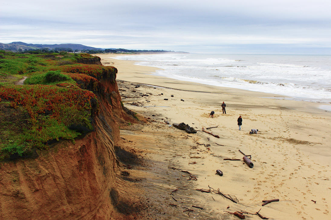
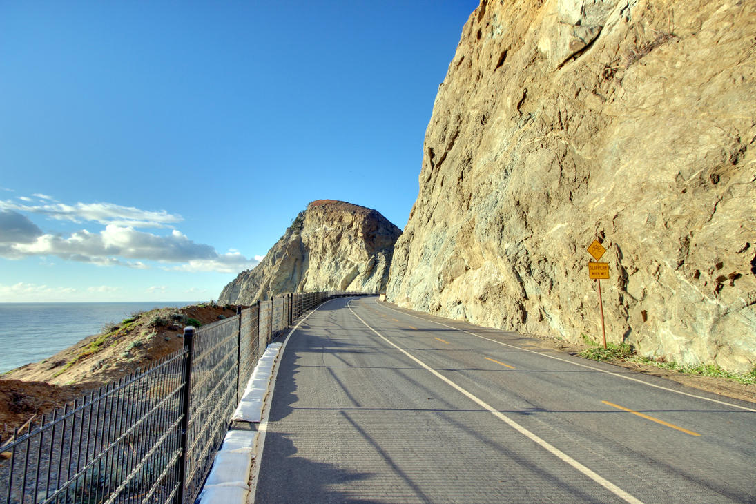

Again, you're on Hwy 1 for much of this road (and this is your last good chance to see it on this suggested itinerary), where the view is one of the primary attractions for the route. There are many places you might be tempted to pull off and look around, and many good places for quick (or long) hikes. If you feel like (what is likely to be) a very private hike to a coastal ghost town that's decayed to the point where the only remaining visible bits are the particularly gothy cemetery with old trees and gravestones covered in Spanish moss, hike out to Purissima [sic], a town apparently named by people who liked the sound of, but could not spell words in, Spanish. There are a few other places along especially worth mentioning as places to stop: the San Gregorio State Beach is right by the turn-off to the San Gregorio General Store (mentioned below) is especially gorgeous, particularly if it's overcast or raining, and it's right off the highway. Pomponio State Beach (just a little bit further south) is also pretty: more extensive, but there are more people there, too. Pigeon Point Lighthouse is gorgeous and surrounded by a designated open space
area that is quite pretty in its own right; it's also the last lighthouse I'll recommend on this trip.
You should also stop at the San Gregorio General Store for one of the best whiskey sours in existence and a reminder that not all of the small towns in the U.S. are filled with foaming-at-the-mouth, sibling-fucking Trump voters. Heading on to Santa Cruz from there will result in a pretty drive but is perhaps a questionable decision overall, given how long it'll take and what the payoff is: Santa Cruz is an expensive town with a UC and a lot of real hippies, but you've seen towns meeting that description before. (On this trip, even.) An alternate, less-time-intensive version of this side trip might go as far as the San Gregorio General Store, then turn east, then north, in order to combine this with the East Bay side trip. To do so, keep heading east along highway 84 from San Gregorio, then cross the SF Bay using either Hwy 84 or Hwy 92; either is a pretty drive, but I myself prefer the drive that stays on Hwy 84 longer. If you're crass enough to want to shave ten minutes off your trip to the East Bay, you can backtrack to Half Moon Bay and take Hwy 92 across the hills, though this is a much less pretty drive. San Gregorio General Store to Oakland Zoo (to pick a reference point in south Oakland) should be 75 to 90 minutes, much of which will be on a pretty, twisting lane (again, unless you're horny for the Interstate, which is visually boring and only saves you a few minutes).
Breakfast: see SF, above. Or just grab coffee and a pastry at Here Comes the Sun (Montara). Or grab a more substantial Sunday brunch at Half Moon Bay Brewing (Half Moon Bay, natch, and near the water, with the approximately 30% surcharge on price for the quality that being near the water always seems to entail; if you're lucky, you might be able to sit outside. Get a Sneaky Peat [sic] if they're on tap). Or have a carby but good café breakfast at the 3-Zero Café (just north of HMB, right in front of the HMB airport), or get a beer and brunch at Sacrilege (HMB; new but promising).
Lunch/Dinner/Booze: If you're getting a late start, Gorilla BBQ (Pacifica) is very very good and has a very dedicated owner (non-pork-eaters can certainly be served, but do read the menu and/or ask questions: pork ribs are their signature dish). Many of the breakfast options just mentioned also serve good lunches (let me once more plug Sacrilege Brewery here). Hop Dogma (Half Moon Bay) has fantastic beer, and not all of them are extra-hoppy, but they're all worth trying. In San Gregorio, the San Gregorio General Store has excellent cocktails (and often music, and is a very good place to shop for small gifts and souvenirs).
Or wait until you get to Santa Cruz and visit one of the tasty restaurants around there. Notably, Saturn is quite good if you're not morally opposed to vegetarian food; there are of course other good places in Santa Cruz, which I admittedly don't know as well as I'd like. New Bohemia Brewing Co. (Santa Cruz) is supposed to be good, though I cannot attest to that from personal experience. (EDIT. Yes I can.) Sante Adairius Rustic Ales is good but doesn't quite live up to its own hype (though that would be difficult for anyone to do).
Additional driving: As a day trip from SF, only going as far as San Gregorio: 40 miles (60 minutes) each way. (Route.) As a day trip from SF, going all the way to Santa Cruz: 80 miles (110 minutes) each way. (Route.) As a one-way trip through Santa Cruz on your way out of San Francisco to Bodie, this adds 100 miles (90–120 minutes) on what's already a long day of driving. (Route.)
Detour: North Bay (Marin/Sonoma County)
You could in theory combine some of these things with part or all of a trip to the East Bay if, say, you wanted to start or end an East Bay day with a hike. Just sayin'.
Getting outdoors is the real pull back to this area. This part of the coast is pretty in different ways than the part south of the bridge: strange but true. The Golden Gate National Recreation Area, just north of the bridge, has some gorgeous options, and bleeds northward into the Point Reyes National Seashore, then to Mt. Tamalpais State Park, all of which is also quite beautiful. Taking these options puts you on Hwy 1 for at least a little bit, which makes it plausible for you to make up for anything you may have missed on (at least the south end of) the most recent Hwy 1 detour on the way down; but heading back north from SF is certainly the less-efficient way to see those things. Mt. Tamalpais (colloquially Mt. Tam
) has many gorgeous hikes, including some free ones led by volunteers, if you want an incredible view, and it's one of the iconic Bay Area Wonders that BA residents love to not ever quite make it out to. If you're hiking it, leave yourself a couple of hours to do so and take the normal precautions: wear good shoes, carry water, etc.
Aside from the outdoor areas you probably didn't have enough time to see on the way in because it was getting dark, my primary point in putting this side-trip here is really to remind you that you could head north again to do this stuff if you're regretting missing anything on the way in.
Additional driving: Depends on what you wind up doing and where you're staying. To pick some reasonable reference points: Golden Gate Park to Mt. Tamalpais is 20 miles (40 minutes) each way, including a drive across the Golden Gate Bridge (and therefore a toll). (Route.) Mt. Tamalpais to UC Berkeley: 35 miles (1 hour) each way, and includes a nice drive along the north side of the SF Bay. (Route.) Golden Gate Park to Russian River Brewing, Santa Rosa: 53 miles (56 minutes) each way, including a drive across the Golden Gate Bridge. (Route.) (Of course, as always in the Bay Area, times assume good luck with traffic, including an implicit assumption that you're not competing with morning/evening commuters, unluckily stuck trying to inch past an accident, or dealing with the wrath of a vengeful deity.)
Day 19 (Tue): San Francisco to Bodie, CA, or thereabouts
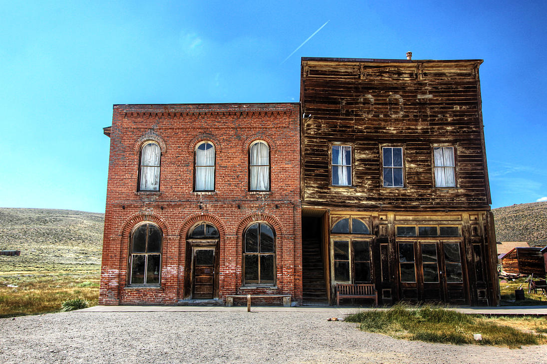
Your goal here is to head east (well … east-northeast) across the width of California and through Yosemite to put you in position to get to the more-than-a-little-amazing abandoned mining town of Bodie the next day, after which you'll move on to Yosemite. You've already got a longish day in the car, but if you want to, you could take the Hwy 1-to-Santa Cruz detour on your way out of San Francisco. It would certainly be the prettiest part of the drive, but going all the way through Santa Cruz would add nearly two hours to how long you're in the car today. On the other hand, if you didn't do it earlier, taking that detour as far as San Gregorio and then heading east is a shorter detour and is your last chance to see a good chunk of Hwy 1 on this trip. You could in theory stop in the East Bay on your way out, too, if you get an early start and there's anything you wanted to do quickly from that detour on your way out.
On the way towards Bodie, you'll pass through a whole lot of not much that's interesting
for quite a while (sorry, far-east Bay, Folsom, and Sacramento), then through the Yosemite area, which is of course gorgeous (you'll get to spend time in it soon enough, but stop on the drive if you'd like). You'll also cut briefly through a sliver of Nevada, probably the only time you'll set tire in a state with no Pacific coast on this trip, then head back into California. You can head into the ghost town of Bodie after you check in wherever you're staying if you really make good time and/or start early, but if you get in after two or so, I'd wait and visit it on your way out the next day: you'll want to spend a few hours there, most likely. (However, there are occasional night events at Bodie, which I've never been to. This is usually because they're much too expensive to be possibly worthwhile, but this summer there are several events that are open comparatively late; this on its own would tempt me to think about rearranging the schedule slightly if I was otherwise close to being able to make it to something I wanted to see.)
If you feel like just a little more driving after you check in to wherever you're staying, there's supposed to be good places to soak in mineral springs around the towns of Whitmore Hot Springs and Mammoth Lakes, though I have never been, myself.
You'll probably approach the Bodie area from the north: it's the quickest route, and you will in any case be driving out to the south, so there's no need to worry about heading through there to avoid missing anything. As you drive in, look for a place to stock up on camping food, because it's going to be a few days before you're regularly around large towns again (though it's not disastrous if you don't stock up on your way: just inconvenient and more expensive in the long run. There will be restaurants and grocery stores available, just not cheaply, nor without a drive, nor will you have access to much in the way of ... shall we say, gourmet options).
My assumption here is that you'll probably get into the area too late to feel like driving up to Bodie after you check in to wherever you're staying and that you'll see it on your way out the next day (which is in any case a short drive).
Breakfast: Grab something in SF, or on your way out of town. It'll be the last big-city breakfast you have for a while.
Lunch: I'd grab something in Sacramento. Tony's Delicatessen has amazing sandwiches if you really just want to grab something to eat in the car; the Curry Club is supposed to be quite good for Indian (though I myself have never made it there).
Dinner: I'd pick up some camping groceries along the road and plan on cooking at Virginia Creek, assuming you stay there: some (all?) of the camp spots have a grill or a fire pit. Alternately, you could drive into one of the nearby-ish towns: Lee Vining has restaurants (though I've only been to Nicely's, which has totally decent diner food). Closer is the smaller town of Bridgeport, which has several restaurants, none of which I've ever tried. Both towns have grocery stores, as well.
Booze: If you missed Fieldwork in Berkeley, you can stop at the Sacramento location instead (and doing so is highly advised, in that case). Track 7 (Sacramento) is also supposed to be quite good, though I've never been. There are bars in the nearby towns, but nothing notable that I'm aware of, and you may just feel like hanging out at the campsite with a six-pack. For things closer to your destination, take a look at the Yosemite plan, below.
Where to Stay: I've camped twice and been happy both times at the Virginia Creek Settlement (Bridgeport), which has some hotel rooms in addition to campsites; also a totally adequate restaurant that's a good place to grab breakfast. Camping
here actually involves sleeping on a bunk bed in a semipermanent tentlike structure (you'll still want your sleeping bags, and probably blankets: you're more than a mile up.) Alternately, there's other camping around, though I've never tried it; or you can find a hotel in one of the local small towns. Wherever you stay, a reservation is a good idea in the summer.
Total driving: 235 miles (five and a quarter hours). (Route, which includes a toll when leaving San Francisco.)
Day 20 (Wed): Bodie to Yosemite
Your two primary goals today are to drive up to Bodie State Historical Park and to move on to Yosemite. But there are some other things to do along the way, if you're feeling perky: Mono Lake is pretty and is just a little way from you (in Lee Vining); it's also an iconic California environmental purity touchstone issue, especially in NorCal (the Save Mono Lake
/Keep Mono Lake Pure
bumper stickers you'll see).
Bodie State Historic District itself is possibly the most well-preserved ghost town you'll ever see and is worth seeing for its size (at one point, it had a five-digit population, despite its brutal winters and the difficulty of access) and well-preserved state of arrested decay. (The legend of the hooker with the heart of gold buried outside the cemetery because of her profession and despite the act of mercy that killed her is a nice narrative, but probably apocryphal.) It's absolutely worth spending a few hours there, wandering around, taking an optional tour, taking pictures, etc. Bring sunscreen and water and your lunch; there's virtually nothing but souvenirs available in the park itself, nor within a half-hour drive of it. After you've seen your fill of the park, head south a bit to Yosemite.
Breakfast: Assuming you're staying at the Virginia Creek Settlement, I'd eat at their restaurant before heading out to the ghost town. Alternately, find a restaurant near wherever you are staying, or make breakfast from the camping-food stash you brought with you.
Lunch: Pack it with you; eat it at Bodie.
Dinner: Pack it with you, or stop and grab something in one of the local small towns (Lee Vining may be your best bet).
Booze: Mammoth Brewing (Mammoth Lakes) is nearby and might be easily combined with a hot-springs trip; I've only tried their IPA 395 (which was good but not spectacular). Black Doubt Brewing is supposed to be quite good, but I've neither been nor tried their beer. June Lake Brewing (June Lake) also has its adherents, though (again) I can't vouch for it personally.
Where to Stay: Book a campsite inside the park ahead of time. Do it now. Take what you can get. If you can't get a campsite ahead of time, you could conceivably continue to stay at Virginia Creek, or get a hotel in a nearby small town … but because of the summer tourist season and the immense draw of Yosemite, I'd try to get reservations ahead of time for those, too.
Total driving: Depends on where you're camping; probably 40 to 85 miles (1 to 2 hours). (Note: as of the time of this writing [late February], the highway connecting Lee Vining to Yosemite is closed, but it will be summer when you go, and so probably there won't be snow. But if you're verifying your route ahead of time on Google Maps, that's why it's claiming it will take six hours to get to the park from Virginia Creek instead of one to two.)
Day 21 (Thu): Yosemite
Well, you're here to see one of the central bits of the wilderness movement in the 19th century—Yosemite was itself instrumental in the development of the concepts of wilderness
and environmentalism
and was especially important to California nature-lovers in the nineteenth century, and Abe Lincoln and John Muir both recognized its central cultural and aesthetic importance in ways that helped to construct the concept of national parks. Which is to say that it's stunningly beautiful all over: there's hiking, rock-climbing, and swimming, for a start; you can take interpretive tours; you can see giant redwoods and amazing waterfalls; you can go cycling or bird-watching. It's a great place for stargazing (but so was Virginia Creek, you know). If you feel like parking and backpacking off into the wilderness, and you have the skills to do that safely, then do it: that's reportedly the best way to see Yosemite. But you can also see good chunks of the park by driving, and there's plenty to do for a day and a half if, like most park visitors, you never leave the Yosemite Valley.
Subjective and contentious opinions on things that are especially with seeing in Yosemite:
- Rocks: Half Dome, El Capitan.
- Redwoods: Looks like the Mariposa Grove is going to be closed through Sept 2017; too bad, it's the easiest redwood grove to get to. But you can get to the Tuolumne and Merced groves if you're willing to hike two or three miles each way to do so. If you do, a stop-off in Crane Flat is recommended.
- The various viewpoints: All of them, at least in the Yosemite Valley; you can see the lot in an afternoon if you're driving. It's totally worth driving from place and place and gazing around slack-jawed in awe. But if you're trying to cut a driving tour short, absolutely don't miss Glacier Point.
Food/Booze: If you want to eat or drink something you haven't cooked yourself, there are in fact a few restaurants, delis, bars, etc. in the park. I've never tried them, though, and suspect that they suffer from the same kind of problems from which other restaurants in national parks suffer: under capitalism, competition is the primary motivation for not being terrible, and there's not much competition amongst restaurants in national parks. Maybe Yosemite is different, though.
Total driving: Just whatever you need to get around the park. You can even get out of this if you're still burned out on driving from your trip out of SF: there are several public transportation services that operate in the park (yes, Yosemite has enough visitors every year to have more than one transportation service), though I've never taken them.
Day 22 (Fri): Yosemite to San Diego
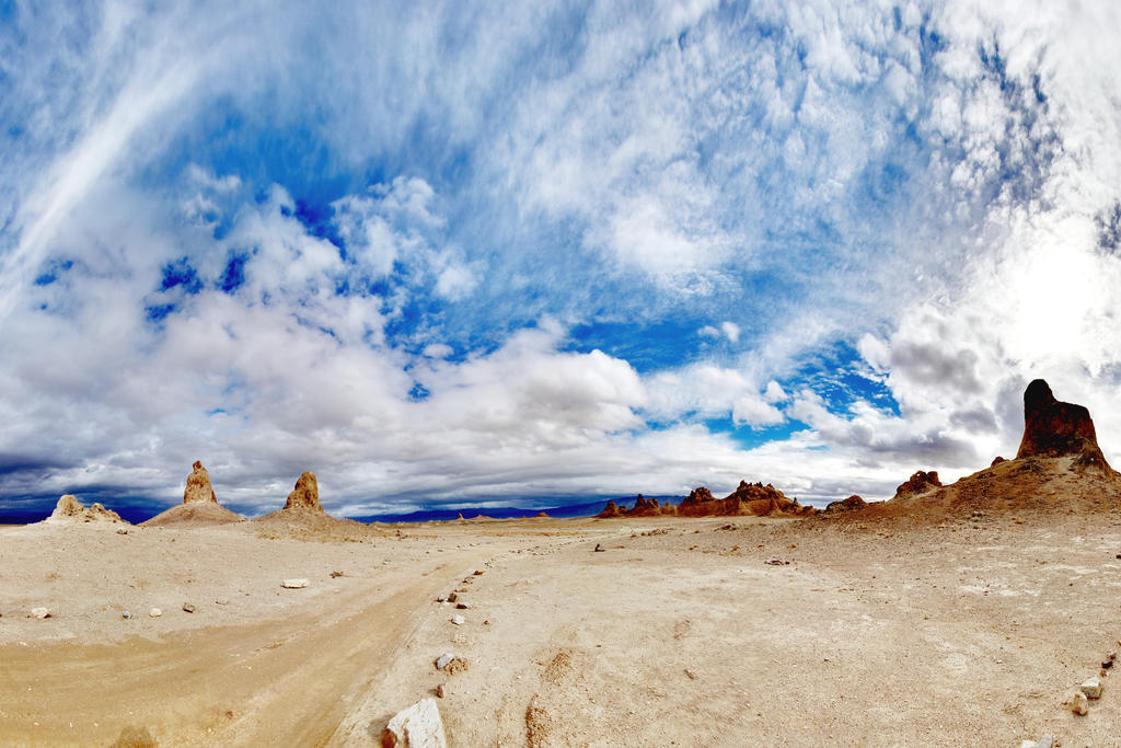
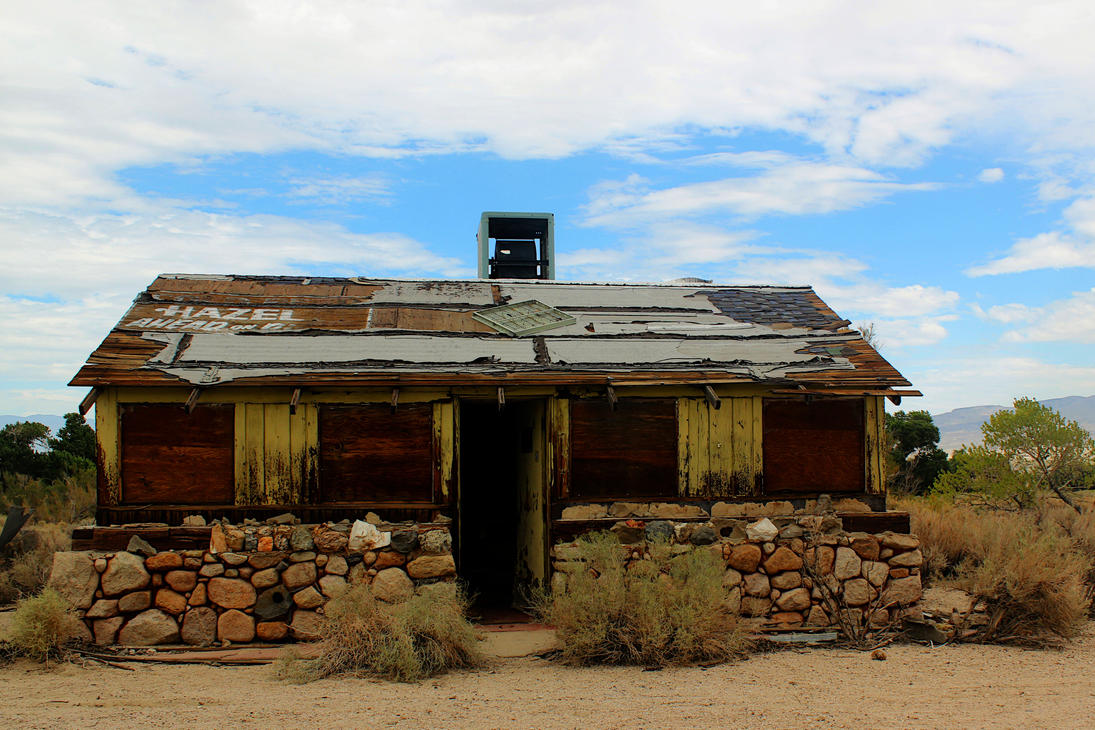
Last chance to see Mono Lake. On your way south, you'll be driving right past an unusual set of geological formations, the Trona Pinnacles—a highly recommended quick stop that you'll recognize as the backdrop for literally jillions of planets in B-grade SF films (and a few good ones, too). (The formation is visible from Hwy 395, as you drive by, but it's absolutely worth pulling off for a closer look.)
Much of what you'll pass through is weird-looking post-apocalyptic semi-ghost towns (this phenomenon peaks in the area around Olancha). The landscape itself is gorgeous, too, and unlike much else on the west coast. Stop and look around at any places you deem appropriate.
Breakfast: I suggest Nicely's, in Lee Vining, for a quick diner breakfast before you move on.
Lunch: You'll pass through towns periodically; many restaurants are overpriced tourist traps, though (again) online reviews will help you here. There is good food, and cheap food, available; or, just pack a sandwich with you. (I've had decent food in Lone Pine and Randsburg, both of which are also very weird-looking places where you might want to get out of the car and stretch in addition to eating.)
Dinner: See San Diego, assuming you're going to make it that far tonight. If you stop early, check your favorite online review site.
Booze: Mountain Rambler Brewing (Bishop, shortly after you leave) sounds promising and has great reviews, though I've never been. Indian Wells Brewing (Inyokern) is one of the few breweries you'll hit before you get to northern LA; their beers are good but not amazing, though it's a good quick stop for a pint about halfway through the day's drive. (If I recall correctly, they have small snacks but not real food.) Euryale (Riverside) has fantastic reviews (but, again, I've never been). Ironfire Brewing (Temecula) is not all that far off the freeway; I like their beer (especially the 51/50 IPA that we sometimes get around here), but have never been to their tap house. I've also heard very good things about Relentless (Temecula), though I've never had their beer, either.
Where to Stay: See San Diego. Or think about taking one of the optional side trips mentioned below and staying somewhere along there.
Total driving: Assuming a start in Tuolumne Meadows Campground: 437 miles (7 hours). (Route.) I'd head out through the east side of the park even if you're camping on the west side: US 395 is a really cool-looking drive, and is (despite how hot it is) cooler than the I-5 corridor, which is dusty and hot and boring. (I don't often suggest that you take the slower route this strongly, but it's not that much slower, and I-5 really is mind-numbing for much of the stretch you'd be on.) This is the only more-than-six-hours-of-driving-day on the southward leg of the trip. Sorry about that. There really are no compelling places to stop unless you want to take one of the side trips below, and powering through to San Diego is recommended, but if it's just too far and you want to split the difference, you'll have plenty of hotel choices once you hit San Bernardino, five and a half hours after departing Tuolumne Meadows. (You can find hotels before then, but you'll have less choice … though it might be cheaper.)
Detour: Death Valley
Tempting and beautiful, but doing this in the summer could very well be excruciating, because Death Valley has a good claim to be, as it calls itself, the hottest place on earth
(a cool summer day is still over 110℉). If you do go, strategize and engage in survival behavior: carry a lot of water even though you can get it in the park; stay near on real paved, or at last very well-maintained, roads; make sure your vehicle is operating quite well; carry food with you; and take water with you if you're going more than a quarter-mile from your car.
To quote the safety verbiage on the National Park Service's map:
This is a harsh environment—any emergency situation can become life-threatening, especially in summer. Heed safety warnings in the park newspaper, including extreme heat and dehydration, unsafe driving, flash floods, and mine hazards. Ask about unpaved road conditions before traveling in the backcountry. Do not use this map for hiking or backcountry road travel.
But it's a worthwhile stop, and is arguably doable in the summer, especially if you're staying in an air-conditioned hotel (or not staying overnight at all) and drive around in your air-conditioned car that you're using to keep your bodies and your several gallons of emergency water air-conditioned. Frankly, it's worth passing through just long enough to see some of the major landmarks and then getting out of the park without sleeping, if you can spare the time to do so; a reasonable route that hits a number of high points might involve stops at the ghost town of Rhyolite, NV; Mesquite Flat Sand Dunes; Harmony Borax Works; Devil's Golf Course; Badwater Basin; Artists' Palette; Zabriskie Point; and Dante's View. This actually gives you a pretty good selection of what can be seen in Death Valley without requiring four-wheel drive or, in fact, getting more than a quarter-mile from your car. (But for fuck's sake, when you leave your car, you should have a bottle of water with you.) Doing those things in that order also minimizes the amount of backtracking and has the advantage of putting you in or near pseudo-towns several times in case you need supplies. And it has the advantage of ending the tour on a high-elevation point that will be much cooler than the valley floor before you have to plunge back down through the heat on your way out of the park. Still, it does miss a lot of things that are also accessible with minimal effort, so read your informational brochure/map on the way in and decide what you want to see.
Food/Booze: If you're taking this trip, pack everything you need, including more than a gallon of water per person per day, with you. Supplies in the park are minimal and rather expensive, and you have to get a fair ways outside the park before you can get much more. Still, you can get food and even cocktails here, if you've a mind to. I will also say that the options are actually better than Crater Lake by a long shot. Which doesn't mean you shouldn't bring your own food and booze with you, because being better than what's available at Crater Lake is like coming in first in a footrace of two, right in front of the guy who just had open-heart surgery immediately before the race.
Where to Stay: If you're doing this in the summer, I'd advise taking one of the several hotels in the park, or in a nearby town (perhaps Beatty, NV). Note that there are no large towns nearby, because freedom. (You think I'm kidding. Now, anyway.) Make reservations in advance. If you are dumb enough to insist on camping in Death Valley in the summer, pick a high-elevation campground and get reservations in advance and bring even more water.
Additional driving: Depends heavily on exactly what you're doing. Just crossing the line into the park boundary and hitting the first plausible stop (Father Crowley viewpoint), then turning straight around adds 45 miles (50 minutes) round trip. (Route.) A plausible as-direct-as-possible trip across the width of the narrow park (to just across the Nevada border, near Rhyolite) adds 110 miles (125 minutes) one way. (Route.) Detouring off of your main route to take the plausible route
outlined in the description above adds 240 miles (4.5 hours) total to your trip to San Diego (but I think it can absolutely be worth it if you've made some changes that buy you a day, or if you're skipping San Diego).
Detour: Mountain drive through San Bernardino National Forest
The whole drive is very pretty, and the two lakes, in particular, are beautiful. You might stop and check out what used to be the first location of the world's first franchised theme park: Santa's Village (Lake Arrowhead; now closed, then reopened, as The Skypark at Santa's Village, whatever that might be meant to suggest, exactly). It used to be a very weird Christmas-themed theme park; but I can't say what it's turned into.
Dinner: Lake Arrowhead and Big Bear are tourist towns that have restaurants; I haven't eaten at any of them since I was a little kid, though. Or you can grab food in the east part of Greater LA after you get out of the mountains.
Booze: People say good things about Brew Rebellion (Redlands), and their tap list sounds fantastic, but I haven't yet been. (But if you go, tell me how it is.) Hangar 24 (Redlands) is also here, but I found their taproom not to be particularly impressive during my single visit to it; they have some good beers, but most of the good ones are available around here anyway.
Where to Stay: There's camping and hotels through here, but again, it's been too long for me to make any particular recommendations.
Additional driving: Just taking this as a drive through the mountains without stopping only adds 65 miles (90 minutes). (Route.)
Detour: Joshua Tree National Park

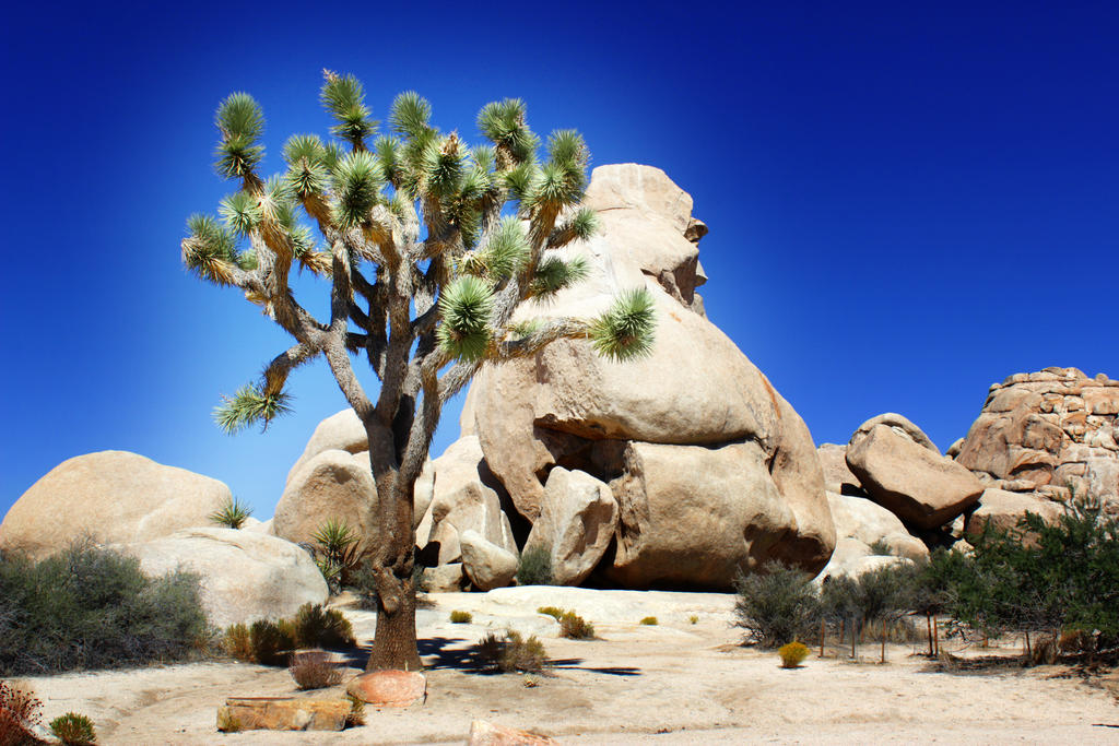
One of the more interesting things about the park is the way that you can see two different overlapping desert ecosystems as you drive through. Of course, there are the eponymous trees, which are everywhere, and the geology has unusually weathered and rounded cracked giant rocks (which have a creepy way of reminding me of people as I see them out of the corner of my eye. Your mileage may vary). You may want to see this sooner rather than later; some studies suggest that climate change is making the park named after the trees uninhabitable to the trees themselves. There are plenty of great places to pull off and gawp or wander off along desert hiking trails in the park. This is another park that you can see most of the highlights of just by driving through the main road that runs NW-SE through the park. (Well—there are actually two entrances that meet up inside, depending on how you want to come in, and both are good options, though the west entrance, near the city of Joshua Tree, takes you through a bit more of the park). If you're taking this trip, though, you're already taking a meaningful detour to get here, so take the time to see some of it from outside of your car; there are plenty of places to stop and take shorter or longer hikes or just gaze at things. Plus, the temperature is much lower than the temperature in Death Valley.
On your way, stop and see the Cabazon Dinosaurs, another roadside attraction that's the brainchild of a monomaniac whose children wanted a quick buck and sold their father's brainchildren to a smarmy consortium that re-framed them as creationist propaganda (mostly in a condescending vein that involves shaking their heads at the poor benighted evolutionist heathens and mentioning the silly theories of the man who designed and built the statues as a self-congratulatory-gesturing-towards-inclusiveness afterthought). So don't spend any money there; but do stop and take a look at the huge, impressive sculptures from the parking lot.
The two larger towns on the north side of the park, Twentynine Palms and (the town of) Joshua Tree, are cool little places with surprisingly decent food and coffee: there's good people-watching in both, because they're full of malcontents and misfits. And there are desert hipsters everywhere. It's cute.
Food/Booze: IMHO, Twentynine Palms has better options than the town of Joshua Tree, though neither has anything that will definitely blow your socks off. At least, not that I've encountered: all of the places I've eaten in these towns that I've liked are now closed.
Where to Stay: There are multiple campgrounds (advance reservations wouldn't hurt) if you want to stay here. Alternately, the closest hotels are along the north edge of the park (reservations wouldn't hurt there during the summer, either). I've stayed at Black Rock campground (excellent). Hotels around here often have a nice quality-to-price ratio. Or you can just power through to San Diego, although that would make for a whole lot of driving (make sure you'll get through the park during daylight if you're going to do this: not to avoid danger, but because there's really not much of a point in driving through at night).
Additional driving: Getting to the west entrance of the park, near the town of Joshua Tree, and then driving through the majority of the park adds 190 miles (3.25 hours). (Route.) If you want to enter the park via Twentynine Palms instead, that saves you 2 miles and 5 minutes of driving over entering at Joshua Tree, which is really not much considering how far out of your way you've already come. (Route.)
Detour: The Salton Sea
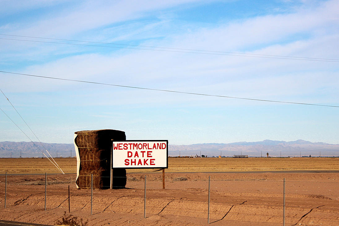
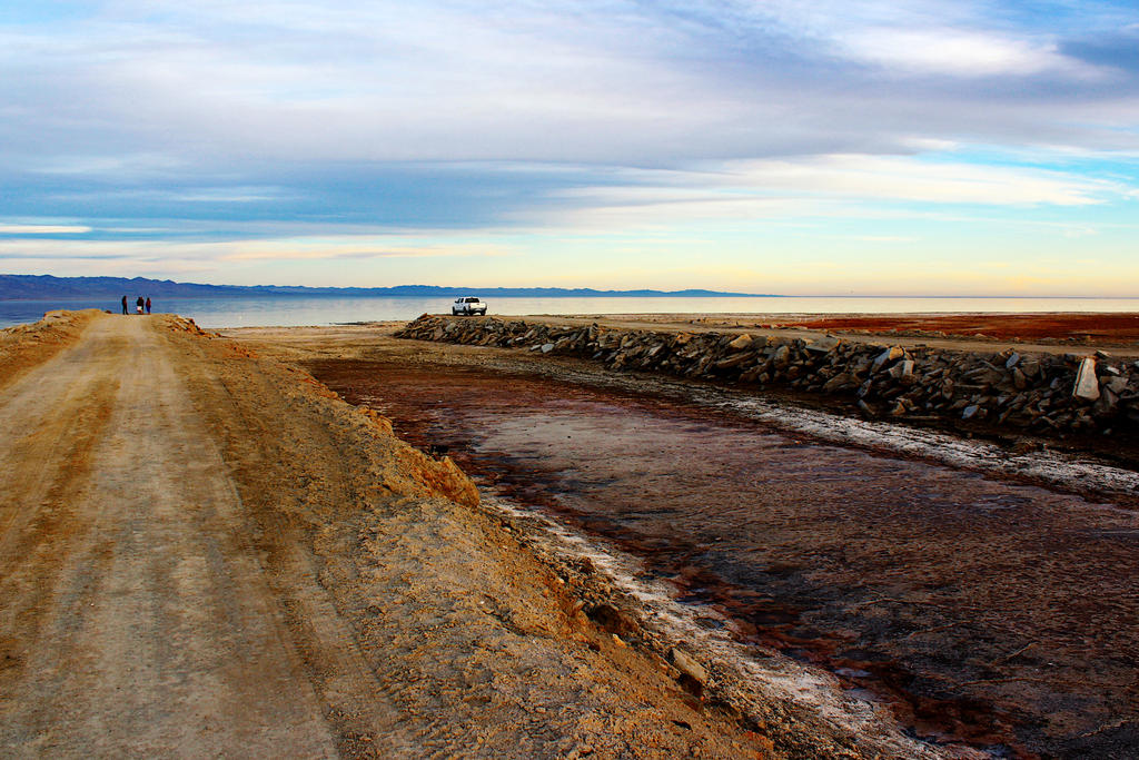
This is a hard side-trip to decide about. It's gorgeous and probably the weirdest side-trip I'm recommending in this itinerary, and it is highly recommended if you can take a half-day or so to do it. Let this short YouTube video sell you on the trip and give you some background on the history and culture of the area, but be sure to read the caveats below before deciding to go.
The good/intriguing: the sea itself is ethereal and weird, but is not natural—it's one of the few engineering errors that's visible from space. Whoops. But it's beautiful, and migratory birds now count on it as a rest stop in their southward travels, so it's integrated into larger ecological structures. Which may make it natural
, depending on what you actually think that word means. Are you at the beach? That's not sand or rocks under your feet. That's bits of fish bones that have been smoothed out a little by the action of the that engineering mistake you're looking at. Similarly, the mud in some parts of the beach is composed to a surprising extent of fish that have been decomposing for years, so don't count on it to support your weight without thinking carefully about whether you're going to plunge up to your knees in fish matter. (You can ask Xenia or Erin about the day I learned this the hard way.) And the fact that this whole area is a slow-motion economic implosion means that property is cheap and it attracts the kind of people who want to go off and live their unconventional lives on their own property, which they've purchased for what has to be some of the lowest property prices in California (you'll see them on the desperate-looking for sale
signs plastered on more or less vacant lots all over). Some, but not most, of those dreams involve the consumption of enormous quantities of meth. Some of these dreams involve the realization of interior artistic visions. Some of them involve getting rich off of date-farming. You'll see it all on your drive around the largest inland body of water in California (this takes about two hours, not counting any stops you make).
The bad: you may have picked up on the mention of fish above, and if you watched the YouTube video I've been telling you to watch, you already know this: late in the summer, the heat and the increasing salinity of the water result in an annual late-summer fish die-off, which is an unpleasant smell. But, if you want to ask a local whether it's plausible to visit without gagging at some particular time, you might try to contact one of the rangers at the campground in Mecca (yes: the first real-ish town you will encounter as you approach the sea from the north is called Mecca
) and ask politely.
But really, this is an amazing place, and if you're intrigued and have the time but can't get an atmospheric report, I'd say it's worth driving down as far as Mecca to see whether the lake is tolerable; you can bail if it's not, and that particular drive, itself, only adds two hours to your trip. Given the views and the weirdness, I'd say, personally, that the potential payoff is worth the risk if it's not yet mid-August or later.
On the way in, think about stopping at the Cabazon Dinosaurs (which I mentioned above, in the Joshua Tree side trip), which you're literally driving right past.
Salvation Mountain is a slight detour within the detour that adds another 7 miles (12 minutes, total for the round trip), but is totally worth it even though it's pretty Jesusy: it's one of the better roadside attractions mentioned on this suggested travel itinerary, an example of how one man with a vision and a lot of donated paint can totally reinvent a surprisingly big chunk of the desert. No one has proselytized to us on two trips, unless you count the hills themselves (but it's hard to hold them responsible). There are also some weird museums here and there; they may be worth visiting, though I've never done so.
Breakfast: I'd grab something in Indio. (Sloan's has remarkable bloody Marys, quart-sized monstrosities garnished with an entire meal's worth of miscellaneous appetizers.)
Lunch: Grab something at one of the few local restaurants, or scrounge something from a supermarket. Westmoreland Date Shake (yes, that's the name of a food place) has decent sandwiches, and you really should try the eponymous shake, which is quite good.
Dinner: I'd get that in San Diego unless you're planning to camp here (you'll be glad to have big-city culinary options again). If you are camping, you'll probably need to bring something in with you: options are few and far between, and there really isn't much even in the few medium-ish towns around the sea.
Where to Stay: There's not much around the lake itself: four or so hotels, total, at least one of which is cash-only. (Yes, really.) I've never stayed in any of them. There is a local resort that kind of ruins its attempt to look upscale by including the acronym RV
late in the business name; they seem to have a lot of billboards the area, but I have never stayed. (The photos on their website seem to hint that they cater primarily to gerontological case studies.) There is camping at a state park near Mecca; it is right near the sea (get up early to go to the bathroom and watch the sun rise over the sea). There is also supposedly camping to the west of the sea in the area of Anza-Borrego State Park and/or Ocotillo Wells, but I've never tried any of that, either. If you're planning on stopping in this general area, the best overall bet may very well be a cheap hotel somewhere around Indio (I've stayed at the City Center, which is comfortable but unremarkable), then seeing the Sea in the morning (a little over two hours of straight driving, hugging the lake as much as possible), then heading onward to San Diego.
Additional driving: Getting to the sea and driving most of the way around it before continuing on to San Diego adds 190 miles (3.5 hours). (Route.) It's much less of a detour if you're also taking the Joshua Tree side trip (or, to a lesser extent, San Bernardino).
Day 23 (Sat): San Diego


Frankly, San Diego is my least favorite stop on this itinerary, and one of my least favorite large west-coast cities; and it requires a good chunk of additional driving, especially if you're not taking any of the other side trips. (But you did ask for the west coast,
and San Diego is an iconic part of that.) One opportunity that it does offer better than other large west coast city is douchebag-watching (there is a higher proportion of aggressive, self-important assholes here than in most of the rest of California). However, if you're not amazed by what I'm about to describe and your own research doesn't turn more up that you want to do here, my own recommendation is that you instead think about expanding some of your other stops or spending the time on some side trips instead. If you're going through the trip backwards, then my frank suggestion is to think about skipping San Diego entirely and spending the time taking the side trip to the Salton Sea, described above. It's a plausible drive from Goleta on day one.
On the other hand, and despite my snark, San Diego does have its charms, and my own ambivalence about the city and the prevalence of self-important Trump-voting douchebags there have fed into my own failure to become more familiar with it, and there are probably amazing things that I don't know about and can't recommend to you because I haven't given it a fair chance.
My own TL;DR: Unless you've discovered an event that pulls you down there at that particular time, or you're going on one of the side trips that brings you close (the Salton Sea, or maybe Joshua Tree), in which case it might be a good place to stop on your way out of that trip, nothing other than the beer is enough to make SD a worthwhile stop. If you're coming for the beer, it's worthwhile; but by now, you've had plenty of beer on this trip if you want to have plenty of good beer, and though it would be sad to miss (especially) Stone, Monkey Paw, and White Labs, that sadness doesn't rise to the level of tragedy.
San Diego is an outdoorsy kind of town, partly because of the relentless sunny weather, and there's lots of parks and gardens. (But they are, to a disappointing extent, manicured and tame prepackaged experiences that have been relentlessly made over to appeal to the lowest common suburban denominator, and don't hold a candle to the outdoors you've been seeing over the last three weeks. But that's just how I feel, of course.) Especially notable is Balboa Park, which is enormous and beautiful; the Inez Grant Parker rose garden (in Balboa Park) is particularly impressive. For things that are worth seeing, you might check out Mission Trails Park and Torrey Pines Natural Reserve, both of which are pretty and have great hiking and are beautiful. There are also supposed to be excellent rock-climbing activities in both places. The website for Mission Trails prominently features their art,
which involves soldiers carved into cliffs. Like most art
in the San Diego area, the point is not to challenge preconceived notions or to pique the person experiencing them into becoming a more developed human, but to honor veterans
with patriotism.
There is also, of course, Sea World, if you want to see intelligent creatures living stunted and harmful lives caged in tiny tanks for the rest of their profoundly shortened time on earth and made to do tricks for slack-jawed under-educated rednecks who like to stare at things that they've never stared at before. On a perhaps-not-totally-unrelated note, the San Diego Zoo (right in Balboa Park) is (in my own, admittedly contentious, opinion) the best zoo you've had an option to see on this trip, though they treat their animals much better than Sea World does, as far as I can tell.
As far as culturey things: there are plenty, but the most prominent tend to be in areas I assume that won't appeal to you (military history and creation science are notable examples), whereas the ones that might appeal to you have better analogues in other cities you've seen. Annoyingly, many museums offer military but not student discounts on admission, because SD doesn't make good decisions about who might have money and/or benefit most from the exhibitions, but instead panders to the many members of the military stationed there. The California Surf Museum (Oceanside) sounds like it may be an interesting bit of pop history, though I've never been.
If you like unintentional postmodernist irony, here is an identical
copy of a plagiarized copy (in a different medium) of that famous kissing-a-strange-woman-on-the-street-without-permission-but-it's-OK-because-I-can-assume-that-she's-a-patriot-and-therefore-glad-about-the-end-of-the-war-and-therefore-owes-me-access-to-her-body photo taken at the end of WWII (you might also note that the title of the statue conflates military victory with sexual conquest). If you read up on its history, you'll discover that the statue was copied in the first place because the original had to be returned, and raising $600,000 to finance the construction of the 25-foot-tall copy from public contributions was no problemo. Because who hasn't always wanted to look up Greta Zimmer Friedman's dress without having to kneel, crouch, or bend his neck? If seeing a plagiarized statue of a soldier forcing himself on a nurse has whetted your appetite for highbrow, funded-by-collection-because-art-is-important sculpture, there is also a statue of a turd that you can drive up to and see.
Breakfast: Snooze (at least 2 SD locations) is a truly great hipster breakfast place (their menu has the words pancake flight
on it). My one experience there was that the food was delicious but the service was glacial; however, it was almost noon on a weekend when we arrived and perhaps the staff's fundamental incompetence on that occasion was atypical.
If you're in Oceanside, The Breakfast Club serves delicious, massive carb-bomb breakfasts, and is totally worthwhile if you're not completely allergic to '80s pop culture worship.
Lunch/Dinner: I'd visit Stone Brewing for a meal if at all possible because it's an excellent demonstration of the theoretical possibilities for the brewpub. The best location is in Escondido, but if you cannot make the short drive out there, their Liberty Station location (San Diego) is a reasonable alternative. One of you should definitely try the beer-and-cheese soup. Seafood is supposed to be fantastic in San Diego in general, and what I've had has been quite good, though no better than other good seafood restaurants in SoCal waterfront towns. I'm told that La Jolla (the actual location of UC San Diego) is supposed to be the home of fine dining in the area, but (again) I've not found it to be so during the few times I've eaten in La Jolla. (But then, I wasn't actively looking for fine dining on those occasions, so my experience is probably not representative.)
Booze: This is probably the beer-densest part of the west coast, with well over a hundred breweries in San Diego. San Diego is also probably more hop-forward than any other West Coast city, Portland notwithstanding, but there are very good beers that aren't hoppy, too. You'll find something you like with the help of your trusty Internets, but here are some suggestions.
Stone (several locations; try hard for Escondido) is the iconic hop-forward west-coast brewery. Escondido is the original and largest and best location; their food is also excellent. They have many brews that are effectively only available here, and not all of them are hop-loaded; they also have an excellent tap list of other people's excellent beer from many parts of the world. I would stop here for a meal, frankly.
White Labs is perhaps the beer-geekiest place in SD County: they're a company that produces and sells brewing yeasts, primarily for beers. Their location has a beer tasting room, which serves (quite tasty) beers that they've brewed themselves; the twist is that they have series of different beers brewed from the same unfermented wort but with different yeast strains, and you can taste and appreciate the differences that different yeasts produce during fermentation. And, again, their beer is quite good, comparative yeast geekery notwithstanding.
Julian Hard Cider has its fans (Vernon may try to sell you on it), and their cider is indeed tasty, but their taproom is small and doesn't serve anything that you can't get in Santa Barbara, and it's a 60-mile (72-minute) drive each way from downtown SD (and about the same from Oceanside, if that's where you're staying).
Monkey Paw is a small brewery that can't brew enough of their delicious beer to distribute outside their own taproom; it's absolutely worth a visit. Ballast Point is from here and has several tasting rooms. St. Archer is here, too. Lost Abbey has two local locations; their primary location is near Oceanside, if you're staying there. And Iron Fist has quite good beers, especially (but not exclusively) their IPAs. Alesmith is also here; again, they're primarily (not exclusively) notable for their IPAs.
Oh, and on your way out of town, you should totally stop at Golden Coast Mead, in Oceanside.
Where to Stay: There are hotels everywhere; plenty of camping, too, if you look for it. Generally, check your online reviews and try to book ahead of time (even if it's just a few hours ahead of time, in the car, on the phone of whoever's not driving) to make sure you have a place to stay, though San Diego is big enough that you're unlikely to be totally unable to find somewhere to sleep. Still, it's no fun to drive from place to fully-booked place.
You might plausibly have good financial luck by trying some of the smaller 'burbs around San Diego; notably, Oceanside is cute, slightly cheaper than San Diego proper for hotels, and only 35 minutes away; it is also the home to the least impressive of the Stone taprooms I've visited (no food; nothing on tap that isn't widely distributed in California). But it's as charming and quiet as you get in the area, and if you're only heading into SD for one day's worth of activity, that half-hour or so isn't so bad; and it's 35 minutes of northward driving you don't have to do on your way out of town.
Total driving today: whatever it takes to get you around town.
Day 24 (Sun): San Diego to Goleta

Head on home. If you've been following the itinerary so far, you've seen all of Hwy 101 in the U.S. on this trip except for the 20 miles between San Diego and Tijuana; if you really need to complete the set, you can take the detour on your way out of town. But really, you're probably just eager to get home, no?
Total driving: 227 miles (4.2 hours)